"All good things are wild and free." --Henry David Thoreau

Wednesday, February 9, 2011

Hike up Corona Heights in San Francisco


Picnic
by Hallie Sinore  
Step into sky
Sift concrete away
Step into sky
Sift high noon higher
Upward, bouncing
Sun-heated breath
Step into sky
Feel green velvet grass 


Milk, orange, gravel
Swallow and share
Cling, downward dog
Babes we care
Mud puddle meets
Brave little lass
Who step after step
Bounces with pep
 Be there and go there
This peak and that one
Mud puddle was
High noon was high
All steppin'  descend
To do it again

Saturday, January 8, 2011

The Labyrinth of McLaren Park

The Labyrinth of McLaren Park

 "So, the Labyrinth is a piece of cake, is it?
Well, let's see how you deal with this little slice..."
--Labyrinth (1986)

 There's a meditative, quiet place in San Francisco where you'll find an awesome spiral labyrinth made of rocks and city detritus, lost toys and found objects, sitting in the green grass, ringed by blue gum eucalyptus, cypress, and pine, at the top of a steep hill in McLaren Park. The ridge-top grove is so secluded, and the labyrinth so lovingly detailed, the place feels sacred.

HISTORY
The labyrinth is an ancient symbol, a combination of circle, spiral, and maze. Perhaps the most famous labyrinth is the one from Greek mythology, a vast and complicated puzzle built by the master craftsman, Daedalus, to imprison the Minotaur, a creature half-man, half-bull. Daedalus architected the Labyrinth so well, he almost couldn't get out of it. 
There are labyrinths in cultures throughout the world, from all different times, more ancient than the Greek myth. It's implied that the theme behind all these labyrinths is their universal spirituality
Starhawk, a famous modern witch and activist, wrote in The Earth Path (2004) that a labyrinth "has a single pathway through it...that leads to a center that's a spot for insight and meditation." In the center of McLaren Park's labyrinth is a rough-hewn wooden bench. Furthermore, Starhawk says, "There are many forms of the labyrinth, from the classic Minoan seven-path labyrinth to the more complex pattern of the labyrinth found in Chartres cathedral." And so we have the San Francisco labyrinth

DIRECTIONS
You'll find the spiral labyrinth in McLaren Park, in the southeastern quadrant of San Francisco. 
The labyrinth is at the highest point of the park, on the ridgeline. Go to the large dog-run area, north of Mansell Avenue and in the middle of the loop of John F. Shelley Drive, and head uphill. 
McLaren Park, by the way, of is one of those rare places that feel almost not a part of the city, with raptors soaring overhead, a wild southern side of steep grasslands, coyotes padding around at dusk, endless secret spots among trees and outcroppings, and three-hundred and sixty degrees worth of views, from the grey, crenellated cityscape, the blue Pacific Ocean, the San Francisco Bay, Mount Diablo, and San Bruno Mountain.  

LAST NOTE
I don't really need to say this, but will in the hope of preserving this treasure from vandalism. When you go, add something special. Fix a spot that might've crumbled. Take away something that definitely doesn't belong. Do something, and it'll come back to you, three times as strong. Blessed be.


View Larger Map

Sunday, November 28, 2010

The Blue Greenway


India Basin

I.
A great thing is in the works in San Francisco: The Blue Greenway, a twisting path running down the bayside edge of The City from the baseball stadium to the curve of broken-rubble beach down by the old football stadium. It's not here yet--but it's on its way. This thirteen-mile section is part of a 500-mile grand plan of trails proposed for “waterfront walking and bicycling paths” along the jagged perimeter of San Francisco Bay.

On one hand, I fear it taking ages to happen. Nearly a decade has passed since the Blue Greenway was first proposed back in 2003. But then again, the wheels have been turning, and progress will continue, especially if more local people get involved.

San Francisco Chronicle writer Will Kane spread the word in early November of 2010 that the Neighborhood Parks Council received a $175,000 grant from the Environmental Protection Agency to “research the best way to build [the] 13-mile path, called the Blue Greenway.”

There’s a call to action. Jane Diamond, Director of EPA’s Pacific Southwest Regional Superfund Division, says the money is also intended “to help residents more fully participate in planning efforts.” Now I’ve just got to find my way to knock on that door.

II.
As a child growing up on Potrero Hill, sometimes my mom would take my sister and I to see a friend who lived down by the bayside at a place we called Shit Creek. The creek’s unfortunate name didn’t start with us; back in the days of the Gold Rush and Butchertown, the quaint name for this neck of the woods, folks dumped odds and ends of cattle carcasses here, shit, blood, trash, you name it. In the hundred and fifty odd years since those days, auto parts places, scrap metal yards, paint shops, and specialty hardware stores moved in, bringing their sweet mix of ingredients to the stew. I was a kid in the 1970s and ‘80s, feeding scraps of bread to birds floating on an iridescent, rainbow sheen of water, blissfully unaware.

As a teen with a bicycle, and then a car, I sometimes went down to the eastern edge of The City, to warehouses located where landfill meets water, and stayed up all night to music I didn’t care about, clustered with groups of young people at the edge of the abandoned MUNI bus yard, befriending one-eyed stray cats slinking under the bushes, warming our hands around small bonfires. By night, this part of town was dark and abandoned, half the streetlights off, and just a few cars going too fast down Third Street. If someone asked me, “What was San Francisco like before all this?” I would’ve said it was marshland. I had learned that in school. But I loved the abandoned buildings, the idea that I could traipse through them like a secret voyeur, like my friends and I were the last people on earth, throwing stones and painting pictures till arms grew tired. And still, I was blissfully unaware.

To realize the essentiality of marshland, I needed decades to pass. Years of working for someone else, for classrooms full of kids. Years of intensely loving other people, and then of losing them. Years of sitting in classrooms and lecture halls, or crouched over a book or computer, learning factoids like 90% of San Francisco Bay has been altered for the worse by mankind.

“You don’t miss the water till the well runs dry,” sang an R&B artist from the 1960s. The words couldn’t be more apt.

And it took a baby; where once I was like, okay, it’s marshland, so what? Landfill schmandfill. What can I do? What can I really do when it’s so easy for someone to press buttons and unleash weapons and blow the whole place up. My baby and I might not survive World War III, but damned if I can’t try to make things better now. Sometimes I wonder if planting that one seed, of literally touching that one rubbery tip of pickleweed growing at the edge of the development site, of chancing upon a heron stalking minnows in the eel grass, if that’s the last moment we have. If it’s the only thing I have, let it be.
Heron's Head Park

III.
What happens when a marshland goes dry? When man fills her up with his trash and quarried rock?

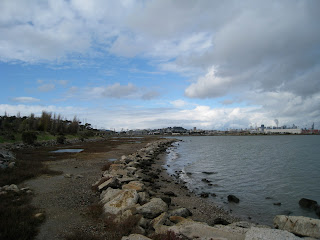
Recently my husband and I went down to the waterfront in Hunter’s Point, a neighborhood next to our more southern neighborhood, Visitacion Valley. We went to see one of the “parks” that the Blue Greenway will connect (the greenest spaces right now, by the way, going from north to south, are China Basin, Agua Vista, Islais Creek (aka Shit Creek), Pier 94 Wetlands, Heron’s Head, India Basin Shoreline, and Candlestick Point State Recreation Area). A family of young parents and their kids picnicked at India Basin. Other than them and us, it was just the birds—brown pelicans, plenty of gulls, long-legged shorebirds whose names I have yet to learn, and little brown seedeaters darting from bush to bush. A veritable graveyard of small, paint-peeling boats rested on the water next to old shacks; this be Popeye’s territory.

Next door in the other direction big machines thrummed in the old naval shipyard, and bright yellow booms floated in crescent shapes just off shore, containing unknown toxic crap in their arm-hold. Clean up has been a long time coming, but its here, spearheaded I believe by Lennar, a Florida-based development company. They’re building over 10,000 units on the landfill of the old shipyard. It shall be a vast commune of condos—far better than a toxic shipyard, in my opinion, but worse than just cleaning up the land and restoring marshland.

IV.
In 1849 the Swamp Land Act allowed and encouraged people to “reclaim” the wetlands. This Act, plus a couple of subsequent ones, granted California 2,192,875 acres for “swamp reclamation.” Nice going, Forebears. A relatively recent inventory of California marshland, as detailed by the Fish and Wildlife Service, tallies us at 457,000 remaining wetland acres.

I guess nobody knew what they meant when they talked about reclaiming wetlands. The shoulders shrugged and the pickaxes swung. Who knew the wealth of a marshland? That its matted rooty tangles could filter pollutants, or give refuge to baby fish? That birds needed to rest here. That water was contained and somewhat cleansed here. Who knew?
At India Basin

And if I knew San Francisco had marshlands, did I care when the mortgage payment kept me working like a dog? Bitter fish grow legs and live on land, you see. But now the pull of the sea draws me back to the waterfront.

According to the group Save the Bay, we can bring wetlands back. It’s really a choice. They say we need to have 100,000 acres of marshland here in San Francisco Bay. When Save the Bay started in 1961, there were only five miles of “publicly accessible shoreline”—now there are 300 miles.

Pickleweed
How does one change an environmental tragedy? How does one like me, who is learning a little too late in life, do something with tangible results? Sometimes all I want to do is sit on the rotted dock and watch the moon rise over the Oakland hills. Sometimes all I want to do is complain.

Perhaps the big change takes one pickleweed plant at a time. (Jeez, it’ll take forever, the curmudgeon in me whines.) Perhaps each pocketful of bottle caps picked up by a waterfront wanderer will make a difference.

With seven million residents in the Bay Area, there’s a lot of possibility. But we just want our gourmet burritos, our winding streets, our iconic image of fog pushing over the peaks, our bridges. 

V.
The industrial southeastern side of SF is not the first place I’d have imagined a waterfront part. Now I can’t help but imagine a trail there. Call it the Blue Greenway, call it our last chance. Peel off the concrete like a scab. 


I see a shoreline made of mud instead of concrete, filled with thousands of shrimp, crabs, worms, clams, and snails, instead of polystyrene bits and bottle caps. And the birds on their epic migrations will be here, as well as the resident species. May the eelgrass and pickleweed grow. May a zillion baby fish be born and thrive here. May the nearly unseen bits of plankton, the shimmery diatoms and larva and dinoflagellates, drift along our waterfront and be touched by sunlight instead of rainbow oil.


Heron's Head


“If I had the influence with the good fairy who is supposed to preside over the christening of all children I should ask that her gift to each child in the world be a sense of wonder so indestructible that it would last throughout life, as an unfailing antidote against the boredom and disenchantments of later years, the sterile preoccupation with things that are artificial, the alienation from the sources of our strength.”  --Rachel Carson (1907-1956)


Naval shipyard

India Basin

Egret at Heron's Head

San Francisco from a boat

Candlestick Park

Old fishing pier at Candlestick Park

Raven at Candlestick Park

"Mudflats" at Candlestick Park

Yosemite Slough

By the entrance to Heron's Head Park
  

Sources:

Alexander, Jean. “A bird’s eye view of The Blue Greenway.” Neighborhood Parks Council. 2003-2007. Retrieved 11/24/10.
Armstrong, P.; Connor, J.; Parsons, C.; Rand, J.; Vuturo-Brady, J. Sea Searchers Handbook. Monterey: Monterey Bay Aquarium Foundation, 1996.
Kane, Will. “13-mile path to revitalize industrial waterfront.” San Francisco Chronicle. November 11, 2010.
Neigborhood Parks Council Press Release, “San Francisco’s Blue Greenway Gains National Recognition & Support from EPA.” November 10, 2010.
Save the Bay 50th Anniversary 2011 Calendar. “Fun Facts of the San Francisco Bay-Delta Estuary.” Save the Bay, 2010.
USGS. “Wetlands of the United States: Their Extent and Their Value To Waterfowl and Other Wildlife, A Century of Wetland Exploitation.” 2006. Retrieved 11/26/10.

View Larger Map

Wednesday, November 10, 2010

SIGN HILL, A.K.A. “SOUTH SAN FRANCISCO THE INDUSTRIAL CITY”


Ever since childhood when Momma drove her red convertible Mustang up 101 towards San Francisco, I wondered about those humungous letters on the side of San Bruno Mountain:

SOUTH
SAN FRANCISCO
THE INDUSTRIAL CITY

What was so great about South SF that they got to hog up the side of a hill with their name? Shouldn’t it just say SAN FRANCISCO? And were those letters painted on, or made of wood like the Hollywood sign? Most importantly, could I get up there?

But Momma had other plans, and we drove on.

"Y" spells "Weeee!"
A short lifetime of distractions kept me from reaching for the letters ‘til my twenties, when I went clambering up the hillside with beer in my backpack and friends at my side. The letters were like big concrete slides going down the hill! Well how’s about them apples! I must’ve tried to joyride them, but I don’t quite remember.

Fast-forward ten years.

On a recent afternoon my nuclear family (husband, baby, and I) ate burritos on Grand Avenue and then took our girl for a swing at the playground behind South SF’s City Hall. Then, bellies full of food, we waddled off in search of yard sales. (I’m thinking I’ve surely hit middle age.) We decided to go up to those letters on the hill.

On the Letters Trail
Sign Hill, the official name where the letters are, isn’t smack up against San Bruno Mountain, but on a parallel ridge. Getting to the letters is easy from Grand Avenue, just a short, uphill walk through a quiet suburban neighborhood.

We climbed up Sign Hill’s eastern edge (the backside of the Letters Trail?), up a fire road alongside eucalyptuses. I had a dizzy flashback from my twenties, but this time my backpack held a 22-pound baby girl and a canteen filled with Hetch Hetchy’s finest.

Looking south
And for the second time in my life, there were the letters, up close and personal. It was very, very cool. There’s a certain thrill from being up so high, sort of lording over the peninsula, looking down at a thousand backyards, and perching next to a monumental letter. It reminded me of trespassing, but it obviously wasn’t.

The Letters Trail was a short jaunt, a mini-hike, although there are four trails to choose from (Ridge, Seubert, Iris Hill, and Letters). We made our way back to suburbia, at the intersection of Poplar and Rocca Streets.

"Warship"--SSF Library
We meandered back to our car by City Hall, and noticed some brass plaques about Sign Hill. It was time to learn some history. Apparently the letters went up in 1923, sixty feet tall and ten feet wide, but were replaced with concrete ones by the end of the decade. South SF was truly an industrial city in its day, home to businesses like Pacific Coast Steel, Western Pipe, South SF Lumber Company, Baden Brick, American Marble, and more. Back then, acres of cattle stockyards undoubtedly stank up the vicinity but supplied fresh beef to the many distributors. Besides the Swift Meat Company and the Western Meat Company, there was the Morgan Oyster Company, and probably a whole lot of other warehouses full of food being shipped across country. It must’ve been exciting. (Back then, freight trains ran to San Francisco, carrying goods up and down the peninsula—and characters like Jack London and Jack Kerouac worked or hoboed on them.) When America became involved in two World Wars, it was the blue-collar folk of South SF who churned out some of our warships. South San Francisco quite justifiably added “The Industrial City” to its name back in 1908.

My husband and I drove back to San Francisco better off for having checked out those massive letters than we were before. Did we feel like middle-aged old coots? Naw. We felt pretty stoked to live in the Bay Area. Did we slide down the letters? Well, what do you think? 


Baby says, "Weeee!"

View Larger Map

Wednesday, October 20, 2010

Liberty Street, San Francisco

My mom once lived in a commune on Liberty Street, back in the 1970s, and so I went there (having forgotten the specific address) to just look at the many Late Victorian houses and tromp the hills with my baby in tow. There are several great staircases bordered by lush plants, so leave the stroller behind.

Liberty runs for just a handful of blocks, running parallel and between 20th and 21st Streets, to the north and south, and perpendicularly hemmed in between Castro and Valencia, to the west and east.

You'll traverse hills, navigate stairways, and see some beautiful views. Sustenance and bathrooms are only blocks away--south to Noe Valley, west to the Castro, and east to the Mission neighborhood.

Stairways not to miss:
--Sanchez to Liberty Street
--Liberty Street between Noe and Rayburn Streets

And if you want to have fun on the STEEPEST STAIRS in the City, deviate your path off Liberty and go to Sanchez and 21st. :-)

Monday, July 12, 2010

Fort Funston: a hike around Battery Davis and onto Ocean Beach

 A month ago or so, we explored Fort Funston in the southwestern corner of San Francisco. It seems it had been years since I visited, and now that I'm reacquainted, I think it's an awesome place to walk in the City. There are so many interesting things to see for adults and kids—WWII barracks, hidden trails behind the bunkers, an area where hang gliders scoot off into the misty blue, and the expansive, slate-grey Pacific Ocean pounding onto Ocean Beach, littered with weird naturalia.


THE BABY FRIENDLY BITS

There are two main hikes, one paved and easy (three-quarters of a mile long), the other suited for babies in slings or children, up and down from the cliffs and forts, and along the Ocean Beach (two and a half miles roundtrip).

There is a drinking fountain on the trail, and very thoughtfully, a spigot and a water dish for dogs.
There might be a port-o-potty somewhere for humans, but I didn’t see one.


THE HIKES

The Sunset Trail (0.75 of a mile) is paved and slightly changes in elevation, but is under trees and in the sun, next to the old bunker of Battery Davis, and is a place where dogs can leap and run around off leash. There are some very cool trails around the thickets behind Battery Davis, but some of the pathways lead right off the high cliff (don’t let your kids or dog gallop down the trails).

The Low Tide Loop Hike (2.5 miles roundtrip) is started on either end of the Sunset Trail. Look for wide, sandy pathways to the beach, the one in the north more sandy and eroded, the other in the south steeper, with steps, and a landscape of bright green ice plant and winding, sandy path down a very cool cliff face. Walk along the beach in a big loop, keeping an eye out for the sea flotsam, huge jellyfish, scads of lady bugs, sand lice. An endangered bird, the Bank Swallow, nests in the cliff faces.

I recommend doing the whole loop of bunkers and beach. 


HISTORY AND WHATNOT

Battery Davis is essentially an artificial hill built into the seaside cliffs above Ocean Beach. It’s an old heavy-caliber gun battery, built just before the Second World War, housing thirty-five soldiers in over twenty-five rooms who manned the big guns and watched the sea (no attack ever hit the west coast), and probably had a drink or two over a long game of cards. (According to an explanatory plaque, when the guns discharged, they damaged neighborhood civilian homes.)


KID ACTIVITIES

If you’re going with a child, consider making a treasure hunt list for things to find, but not keep. If they can’t read, you can draw pictures. Things in the vicinity include round stones, ladybugs, jellyfish, sand dollars, yellow or purple ice plant flowers, driftwood, black, grey, or yellow sand, pieces of plastic.

Another idea is to be a Super Trash Collector! Bring along a container or bag for collecting little pieces of plastic off the beach. Teach the kids about the horrendous plastic gyre in the Pacific, and do our part to pick up little bits of plastic that might otherwise end up in the gyre.


RELATED HIKES

Click here for an article about hiking around Lake Merced (across the road from Fort Funston), as well as some other articles I have on Examiner.com. 


MAP AND DIRECTIONS


View Larger Map

Monday, June 28, 2010

Call for Articles!

I would love to publish other people's writing on Hill Babies! The only guideline is that the article be about hiking with children in the Bay Area.  If you're interested, please contact me.  And if you know a writerly hiking type of parent or caregiver, please tell them about Hill Babies.

Thanks,
Jessica

jericahahn@hotmail.com