"All good things are wild and free." --Henry David Thoreau
Showing posts with label marshland. Show all posts

Friday, February 8, 2013

Pescadero Marsh Natural Preserve: Sequoia Audubon Trail

Coastal bluffs north of Pescadero Creek
Bufflehead Duck
Being very pregnant yet needing a walk that wasn't too strenuous, I thought of Pescadero. I wanted a place that was flat, full of wildlife, and close to water. The other weekend my husband, daughter, and I explored Pescadero Marsh Natural Preserve, hiking trails we had never been on, but were so impressed by, we planned to return again soon.

To get here, we drove approximately forty miles south of San Francisco on Highway 1. When we crossed the bridge over Pescadero Creek, we took an immediate right into the first parking lot for the beach. There's a rudimentary bathroom there, and a heartening sign about bi-monthly marshland walks--we were in the right place.
Sequoia Audubon Trail Map,
courtesy http://www.parks.ca.gov

Our destination was the Sequoia Audubon Trail along the southern edge of North Marsh, one of several trails in the 600 acres of protected marshland. We had read that there was always wildlife present (230 bird species annually), and plenty of flora (200 species), including some wild and weirdly shaped eucalyptus trees that had been gnarled by old floods. Most essential for my physical state, the roundtrip mileage was about two miles.

We went by foot north across the bridge on the pedestrian walkway, then under the bridge.

The beach was so compelling that we could've spent a day just hanging out here. The sand was soft, and the confluence of Pescadero Creek and the Pacific Ocean seemed like a magical site for wildlife. The beach itself was full of twisted driftwood and human-made sculptures that were like windbreaks, and very few people. Sand pipers scampered along the shoreline in swift-moving flocks, and gulls sailed overhead. An informational kiosk, burnt yellow by the sun, informed us that rainbow trout, also known as steelhead when they reach the sea, spawned here.

We walked under the bridge, traveling along the creek's smooth, sandy shoreline for about a hundred feet. The sand was so soft, and the water so still, it was tempting to stay here all day too. But we saw a trailhead to our left with a small sign reading SEQUOIA AUDUBON TRAIL, and went down it.


The trail was sandy, soft on bare feet. On either side grew a kind of coyote brush I hadn't seen before, very low lying, close to the ground. I recognized lots of coastal buckwheat, and wondered what butterflies might be here come springtime.

Sequoia Audubon Trail start
One of the interesting aspects to this trail was the number of informational signs regarding flora and fauna. With the help of the ones we passed along our route, we could find live examples of salt grass, California bulrush, and common pickleweed. Among the plants I'd like to touch were stinging nettles and poison oak, two to be avoided. (Suffice to say regarding the "untouchables," we did not get any stings or rashes after this trip, and we do like to press along the edges of the trails.)

Other plants we saw included healthy bushes of lupine, still to bloom later in the season, feathery-leafed yarrow, and invasive (but pretty when flowering) ice plants.

Eventually the trail was hard packed earth, though because of the amount of sandy stretches, I would highly discourage anyone to attempt this with a stroller.
Dusky footed woodrat
Credit http://ucsantacruz.ucnrs.org

We rested on a weathered bridge leading to the North Marsh Trail, and ate oranges in the sunshine. Our daughter pretended she was a goat from the Billy Goats Gruff fairy tale.

We continued on, and some docents we met suggested we eat our lunch at Turtle Pond, half a mile up on the right hand side before a bunch of dusky-footed woodrat nests.

Great Egret, credit: wikipedia
Across the marsh we saw dozens of birds, including a snag of a tree that had become a rookery for great egrets, snowy egrets, and great blue herons. How lovely to see these birds flying, graceful, with long necks and wings.
The wild-looking eucalyptus


We passed an incredibly twisted eucalyptus tree along the trail that had been shaped by floods. The thick branches hung low to the ground, and were like magnets for our small child. Shadows and light filtered over branches and leaves, and we could've easily spent the rest of the day here, hugging the tree.

Only a mile or so along Sequoia Audobon was a short and somewhat overgrown path veering to the right, and we took it, hoping it would lead us to Turtle Pond as the docents instructed. Water glimmered through the trees.

Western pond turtle, credit: Wikipedia
Sure enough, there were two benches here, as told, and a downed tree hanging over the water. Though we didn't see any red-legged frogs or Western pond turtles, both natives to the area, we had a tranquil picnic beside the water. We wished we had a little rowboat to cruise and down the creek from this point.

We did walk further on the Sequoia Audubon--we'd been told there was a lookout and loop at the top of a low hill just up the way. But the day was cold, though sunny, and after we passed by a half dozen dusky woodrat nests, and under willow trees loaded with buds that were not yet in bloom, shivering in the shade, we turned around. We had had a great walk and picnic, and would return again another day.

Ronnie Duarte and our waitress, Bernadette
Back at our car, we decided to drive into the tiny town of Pescadero to visit Duarte's Tavern, a restaurant that had been around since the late 1800s. We ordered our favorite: artichoke soup for starters, whatever entree looked good for the day, and fresh pie. (We usually get ollalieberry, a local speciality, but today I was craving pear pie.) And we're we lucky--Ronnie Duarte, the proprietor and an old-timer with a good sense of humor, came over to chat with us and tell us about how to grow ollalieberries.


**********************

PHOTO ALBUM

The Highway 1 bridge over Pescadero Creek
Land along Pescadero Beach


Sequoia Audubon Trail

Sequoia Audubon Trail thinking

North Marsh
Heading east on the trail
Turtle Pond 
The little trooper and her momma (above)
and with her daddy too (below)

Driftwood sculptures along the creek
Pie and ice cream at Duarte's Tavern
--a post prandial perambulation delight

View Larger Map

Friday, September 14, 2012

Map of Heron's Head Park for the walk on 9/15/2012


This should actually read "Heron's Head Park & India Basin Playground" as we're checking out both places, connected by a trail along the water's edge. 

The walk is from 10 am to noon, but flexible; come and go as you please. 

A clean port-o-pottie is near the EcoCenter building at Heron's Head.  

No need to print this--I've got you covered with copies already made. 

--Jess  :-)

Thursday, September 6, 2012

Pier 94 Marshland: sea lions, pickleweed, and a tenuous environment

With some trepidation and a whole lot of doubt, my friends, my daughter, and I drove down the most industrial street in San Francisco, called Amador Street, in the Hunter's Point / Bayview neighborhood....
looking for Pier 94


There couldn't be marshland down here! We rolled past a massive abandoned silo-looking building, a rendering plant (or something nasty) that stank to high heaven, and enormous piles of aggregate for making concrete.
Big Industrial Momma, what were you in times past?
Now, I'm a lady fascinated with industrial plants, and abandoned ones are even more cool, but when I'm on a search for marshland, the industrial sector leaves me doubtful.
Cranes to inspire (or scare) the children
Flowering Pickleweed

Yet Pier 94 was at the end of Amador, its entrance marked by a lone port-o-potty and a printed placard posted at the far end of the most unlikely looking parking lot.

Greenery spread for acres beyond the chain-link fence, and beyond that was the shoreline with cormorants, pelicans, gulls, and even one beautiful sea lion.

WHAT IS PIER 94 MARSHLAND?
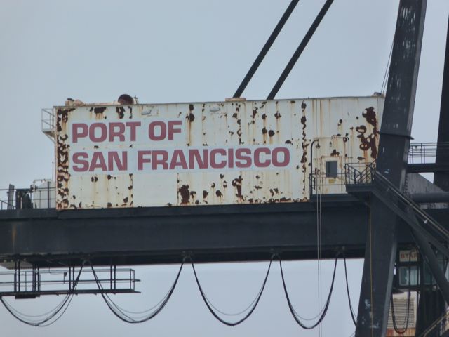
It is a tidal marsh that has become protected in large part by the Port of San Francisco (see their link here).
The Pier 94 Marshland is a gorgeous five or so acres surrounded by the heart of industry in San Francisco.

One day it will be part of a connected series of green spaces along the perimeter of the city, the Blue Greenway.

Right now, Pier 94 could use some visitors and attention. 

According to the fellow from Audubon Society who my husband and I met last Saturday morning, during the Audubon Society's monthly cleanup and caretaking of this site, this was a dump of flotsam and jetsam a some years ago.  Even last Saturday, he hauled a soggy mattress away.

I wandered around with my garbage bag and my kid, but there was barely any trash. Instead I saw pickleweed galore, flowers, and birds. I saw mud and slime, and lots of rocks.

Then my daughter and I sat at the water's edge and a sea lion poked its head out of the water and watched us for a minute. We were very impressed! 


HOW TO HELP PIER 94
Pelican and gulls
Just going out to Pier 94 and acquainting yourself with the marshland restoration situation in San Francisco is great. Nobody has to "do" anything, as sometimes the best action is to just appreciate something.

I'm starting to realize I should always carry a plastic bag to pick up trash when I hike with my kid. It's good practice, so I recommend it to you too, whether you come here or elsewhere.

The first Saturday of the month is a volunteer workday. To get involved with restoration, see this page on the Audubon website. You could always just show up at 9 in the morning.

My husband and I came with our toddler. While Marshall worked on digging up invasive weeds,  the kid and I did what we could, which wasn't much! I picked up trash but mostly ogled at the wildlife juxtaposed with the incredible man-made structures.
Cormorant
Homo sapiens, mom and daughter
Look for this sign!


View Larger Map

Thursday, February 17, 2011

Heron’s Head Park


On the southeastern shoreline of San Francisco, birds are coming back, and native plants like sea plantain, coming back to a place called Heron’s Head Park which has undergone a phoenix-like transformation from its original incarnation as landfill. At least 68 or so native species have been planted here, one at a time, many by local school kids. Literally thousands of tons of debris were hauled away in the making of Heron’s Head Park, some years ago. Ever since the sea-change to bring back the marshlands occurred in relatively recent times, people are working hard to make places like this not only good for humans, but also for the local flora and fauna.

Heron’s Head Park juts out into the water like its namesake bird, and straddles two worlds—the old industrial one of warehouses built onto docks and hulking tankers, and the world of pickle weed, eelgrass and plovers. Along the walk there are interpretive signs on the local flora and fauna, and man’s impact. At the tip of the heron’s bill, so to speak, is a boulder-strewn area where you might spot a seal. You will certainly see a lot of birds.

Heron’s Head Park is also home to the Eco Center, built on a hillock by the main entrance. It claims to be the first environmental justice education facility in the Bay Area, and to that end it is both off-the-grid and plugged into the local community in terms of ecological education and outreach. It’s a very cool looking place with a living roof, a model marsh inside, and impressive water tanks.

This is a great spot for a stroll or a walk with a child. Dogs on leashes are welcome (but boy can dogs freak out nesting birds), and bicycling works too. There are about 25 acres here, with 8 acres (off-limits to humans and dogs) of intertidal marshlands, and all of it is flat. 

If you are game for extra exploration, follow the bay trail south along the former PG&E site—it’s all well marked with trails and some signs—to the India Basin playground. Further south is a Popeye-looking collection of ramshackle houses and boats, and then India Basin Park, another open space destined for marshland restoration, hopefully, in the near future.

Last Notes
If you liked this article, please click here to read about the Blue Greenway, a proposed trail system along SF’s southeastern shoreline.

 Click here to read a poem about Heron’s Head by Hallie Sinore.


Directions 
Take 3rd Street to Cargo Way. Head east on Cargo to it’s end, where there is a parking lot at Heron’s Head Park.


Heron's Head Park Poem & Impressions by Guest Writer Hallie Sinore


Heron's Head Park
by Hallie Sinore

Never underestimate the power of moms to show up in numbers with their all-star babes on a beautiful day. That's what happened Friday 2.11.11 at Heron's Head Park parking lot and at the amazing Ecocenter. At noon, the parking lot went from empty to full in ten minutes flat. Maybe the wetlands were also part of the draw, offering stark contrast in terrain to last week's steep ascent. As for the babes - some were carried, some made us chase them, and others rode in strollers. Yet another babe was in the making!

This walk was forever flat, perfect for relaxing chat. The type of hike that doesn't call for a sense of direction - salt marsh water on both sides of the path, with a mirage of water at the end. Maybe it was real, you'll have to fill me in. We picniced as we do, just cause. I lost track of time and distance, until the turnaround.
Forever flat,
Water on both sides
Wetlands wet
Fill me in 
On path's end
Was it mirage 
Or real
Water-

Forever flat,
But blueberry round, 
All pregnant
With possibility.


Moderator's Note:
For more on Heron's Head and the Blue Greenway, please click here