"All good things are wild and free." --Henry David Thoreau

Wednesday, August 22, 2012

10 Great Hikes Throughout San Francisco

I just wrote an article about ten places to hike in the City, covering one hike in each of the ten main districts. The compilation was a challenge, as there are so many places I like to explore, and there wasn't enough room to include even half of them. (Perhaps there should be a part two?) For ideas about where to wander with little ones in San Francisco, from Land's End to Telegraph Hill, from Alamo Square to the Visitacion Valley Greenway, please check out the link below to OnlyInBayArea.com.

Cheers,
Jess

http://www.onlyinbayarea.com/Article/Details/Best-places-to-hike-in-san-francisco-with-kids 

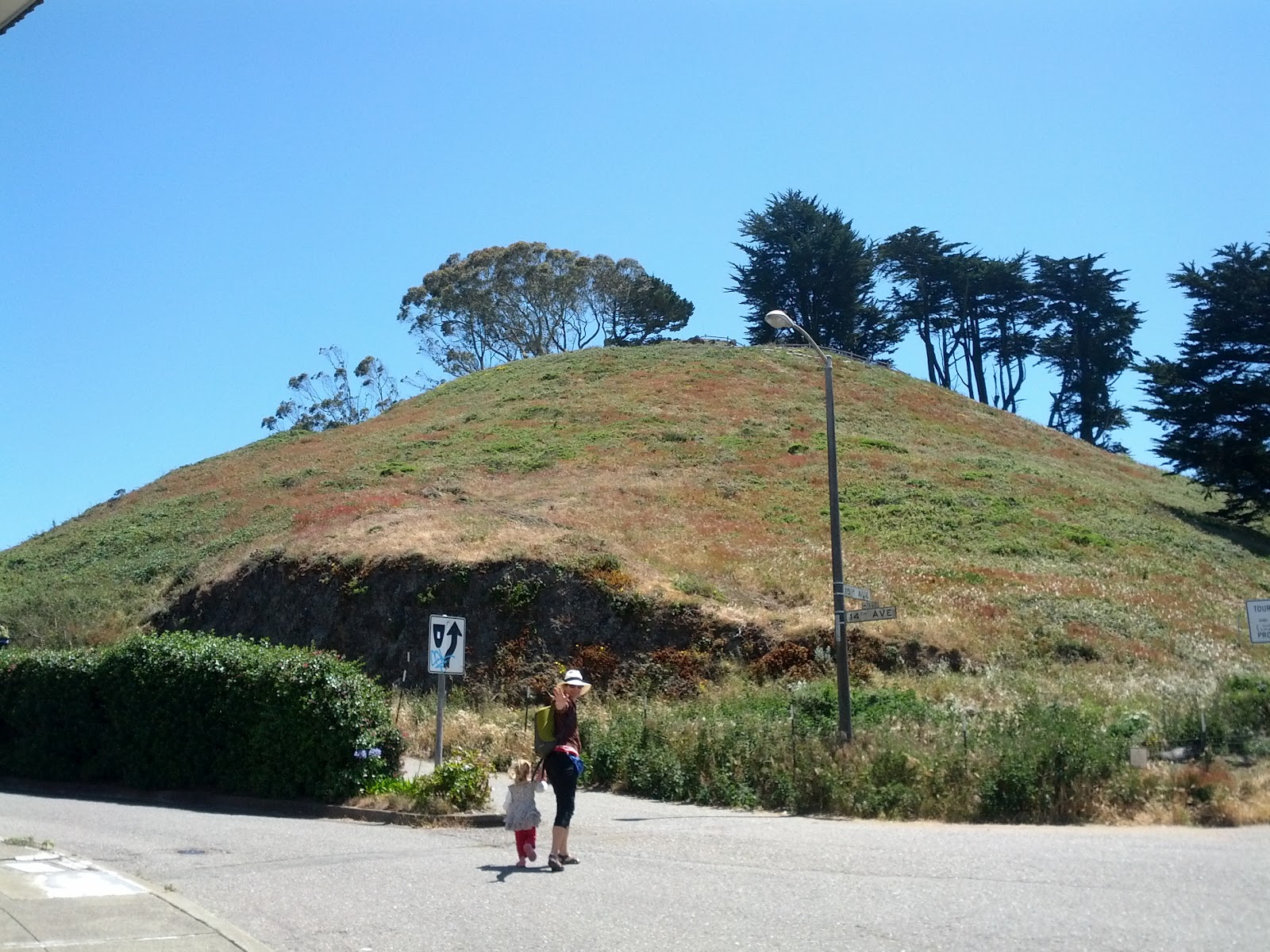
Grandview Park, aka Turtle Hill, of SF

Friday, August 17, 2012

Upcoming Hike for Kids and Caregivers!

You are invited to come for a walk at Candlestick Point State Recreation Area with friends, kids, and people newly met. I'm doing these monthly hikes just as a way to move my body, meet interesting adults, and let my kid play with a big old gang of kids the old fashioned way, outside. All ages welcome. Free and unsponsored.
Hanging on the beach at Candlestick SRA
WHEN
Sunday August 26th, meeting at 9:30 AM. Why so early? Because 9:30 am on that day is the peak of HIGH TIDE, and down by the water that means it's pretty special--extra lovely and smells wonderful. :-) 

WHERE TO MEET
Meet near the bathrooms at the main parking lot off of Hunters Point Expressway (it's actually a south of the indicator on the map below, FYI). You'll see the group. I'm going to make and Xerox maps for everyone, pointing out some local sights and where our picnic spot will be.

THE HIKE
The terrain is flat, and the trails are wide and smooth. If your kid rides a bike or a trike, that would be great way to explore. I'll be on foot, going at the speed of my three-year-old.

The hike is meant as a group thing, but with map in hand you are totally able to go at your own pace. One can always rendezvous for the picnic.

WHAT TO BRING
Food and water
Sun protection
Layers of clothing
Fun and optional: kites, bikes, trikes, rollerblades, skateboards

GETTING THERE
Parking is free (exit at Candlestick Park off of 101 and head towards the water, following signs towards Hunters Point Expressway). For public transport, see: http://tripplanner.transit.511.org 

Cheers,
Jessica

OPTIONAL GUNG-HO HIKE
Anyone who wants a five-star hike could explore nearby Yosemite Slough, a tidal channel that has been polluted, but is now receiving a $14 million dollar restoration. The Slough is a fantastic place for bird watching come fall, and home to the endangered clapper rail.

One of the beaches at Candlestick SRA
Group Hikes in 2012
1        May—McLaren Park’s southern slope

   June—Bayview Hill
   July—Visitacion Valley Greenway
   August—Candlestick Point State Recreation Area
   September—?

Possible Future Hikes
Glen Canyon, Mt. Davidson, Lands End, Heron’s Head, Grandview Park (on the Green Hairstreak Butterfly corridor), Sign Hill in SSF, Russian Ridge, Rock City on Mt. Diablo! Basically SF and close by. Everyone is welcome.

Thursday, August 9, 2012

The Spiral of Potrero Hill


“What is art /
 But life upon the larger scale, the higher,
 / When, graduating up in a spiral line
 / Of still expanding and ascending gyres,
 / It pushed toward the intense significance
 / Of all things, hungry for the Infinite? / 
Art's life—and where we live, we suffer and toil.”
---Elizabeth Barrett Browning, Aurora Leigh (1856), Book IV, line 1150
Child walking the spiral of Potrero Hill
Fifty thousand years ago humans began drawing spirals, beautiful and simple, a curve drawn from a central point, looping around and around a center point. They have an archetypal resonance, something deep and ancient, although they are found in commonplace things--the cross-section of shells, flowers petals, seed clusters, birds soaring on thermals, or water going down a drain.
One day my child and I found a magical spiral made of stones in a hidden spot in San Francisco.
The Spiral of San Francisco

We had been visiting my mom on Potrero Hill, and went to my favorite childhood open space, where I used to ride down grassy slopes on cardboard. My friends and I called this place “The Field,” but now it's known as the Starr King Open Space, a protected environmental area thanks to the organization of contemporary neighbors. It's three and a half acres around Carolina and 23rd Streets, De Haro and 24th Streets, and where Carolina intersects with Wisconsin Street.

 It was late summer and the grass was dry, the poppies golden, and the views from the serpentine outcroppings incredible and clear, sweeping across the valley that the City appears to be. We wandered up the hill, past the grove of eucalyptus trees rattling in the wind, and towards the back part.

In the far southern end of The Field, almost at the fence that borders neighboring yards, a large circular pattern of serpentine-looking stones appeared in the grass. It was a spiral, maybe fifteen feet in diameter, much like the labyrinth of rocks in McLaren Park, both having great artistic value and a spiritual nature. I followed its path curving in, then followed it out. 

Meditative Aspect

Walk the spiral any way you like, but if you do it in a meditative way the experience is only better, in my opinion. Humans impart meaning, and many believe the spiral symbolizes life, death, and rebirth through its motion. One might focus inwardly when walking towards the center, and focus on expansion when walking outwards.


Final Note

As with any spiritual place, care and respect ought to be given to this spiral—perhaps by adding a stone to its walls, or finding something out of sync that has blown in, like a candy wrapper or a broken branch. Enjoy it while it lasts in this ever-changing city of hundreds of thousands of people. It is one artistic and spiritual destination, a contemplative space in the midst of frenetic energy. And blessed be. 


Relevant Links


At a serpentine outcropping, facing southeast


Sunday, July 29, 2012

Fairies in Oakland? Fairyland at Lake Merritt

As one who prefers trails of dirt to those of concrete, and outdoor wonderlands made of trees and caves and creeks, I was a snob about visiting the Children's Fairyland in Oakland.

Then I visited and now I repent my snobby ways.


THE WORTH OF A VISIT
Children's Fairyland is the best man-made children's park I've ever been to, seriously, and blows doors on any modern playground or amusement park. I also happen to be a lover of myths, legends, and fairy tales, so this was a treat for me too.

I was afraid the setting would be hot, literally baking like most playgrounds constructed of artificial things in the middle of a city, but most of the play structures were under enormous oak trees, redwoods, and along a meadow. Flowers bloomed everywhere, and the place felt cool and refreshing.

I came for a play, but fell in love with the place. With forty different fairy tale and nursery rhyme settings, how could I see all of them? Then there were puppet shows, a hill to slide down, farm animals (I only saw the two donkeys), rides, a day camp, overnight possibilities, and more.

REAL-LIFE CHARACTERS
Blossom the Possum
We met some interesting characters there, and not just from fairy tales. There was a couple of my parents' generation: a visiting wizard named Oberon and his fairy-wife, Morning Glory, both sweet as can be, carrying a gentle opossum named Blossom in a knitted bag. (As an aside, they run a wizardry school, GreySchool.com, worth looking into if you like magic)

HISTORY
I love history and old places, and Fairyland opened in 1950, when my mother was a little girl and long before Disneyland existed (there is a rumor, or truth, that Walt Disney was inspired when he visited this park). 

Fairyland in the Fifties. Photo from alamedainfo.com 
As I wandered around, following my daughter as she went from carousel to toadstool to crooked house to rabbit hole to the belly of the whale to pirate ship, I thought about the generations of children who have explored this place. There's a cool retro style to the place, a real Fifties vibe. 
Fairyland in the Fifties. Photo from alamedainfo.com
HIKE AROUND LAKE MERRITT
Fairyland is right against Lake Merritt, a tidal lagoon that continues to draw enormous flocks of birds and resident Canadian geese. The walking path around the lake is a little over three miles, and there are boats one can rent, plenty of food places, and easy public transportation, like BART, nearby. 


DRAWBACKS TO FAIRYLAND?
One drawback to Fairyland is the price, $8 per person (everyone 1 and older), but that's not so bad considering entrance includes unlimited rides (carousel, train, Ferris wheel), and the place is a nonprofit organization where you can volunteer in lieu of payment. Membership only allows those people named on the card to enter (meaning no loans to friends or babysitters). Free passes can be obtained, according to Fairyland's website, but I don't know how easy they are to get.

LAST NOTE
The next time I come, I am going to pack a picnic (there's food to buy and an espresso bar, FYI), and maybe bring a book or two of children's fairy tales, plus a Mother Goose nursery rhyme book. Maybe a big ol' floppy hat too, since it's always so much sunnier in Oakland than SF.

Related Links:
Fairyland, Official Website
Bay Area Children's Theater

the ancient donkeys of Fairyland
Anansi the Spider's Ferris Wheel


SPECIAL SUMMER TRAVEL: BATTLE ABBEY, 1066

THE SITE OF THE BATTLE OF HASTINGS IN 1066 AD

A mash-up special posting by Sara Kerry, Tiki Stew, Laura Waters,
Marshall Hahn-Taylor and Jess 

On a lovely summer day in southern England, a group of adult friends and three kids  (ages 2, 6, and 9) decided to explore a new place for all of us: Battle, just outside of Hastings in East Sussex, England. Not only was it a majorly important site in British history (in 1066 AD, William the Conqueror and the Normans battled King Harold and the English here), but there were trails, a ruined abbey, an interactive museum, and a meadow where the pivotal battle occurred. The site of the Battle is a rough field, shrouded by undergrowth and trees--rendering reenactment perhaps impossible. :-) There is a very good visitor centre with some artifacts, audio and a short film about the battle that help to bring the site to life. On the ride home, we agreed how  everyone in our group loved the place. 

The six-year-old loved the interaction---the audio guide, the way he could pick up the Norman shields in the museum, the grass hopper he caught in the field, and that there was nothing restrictive about the place. Everything encouraged him to use his imagination, especially when he ran amok, exploring the ruins of the old abbey (that William the Conqueror built after his success).
The nine-year-old loved the independence---that she could go on her own down the trails and in the abbey, listen to the audio guide instead of hearing adults yammer at her, and the chance to order a piece of cake and a cup of tea at the cafe. She also appreciated the short movie in the museum.

The two-year-old loved the sensory experience---handfuls of fresh blackberries that she picked along the trail, running through the meadow which was the battlefield, and chasing the other children in the old abbey.


HISTORY
Battle marks the site of the last successful military invasion of Britain. The Normans were originally Vikings who settled in northwest France in the 900s eventually creating a powerful state - Normandy. In 1066 William, who had a claim on the English throne, defeated King Harold at the Battle of Hastings and was crowned King on Christmas Day. A new alien aristocracy was imposed on the English population. The Normans dispossessed many Anglo-Saxon landowners, pressed the peasantry into service on their feudal territories and treated their subjects with contempt but they also taught better farming practices, developed the economy and built fine stone cathedrals and churches.

The abbey was founded by William the Conqueror in thanks for his victory and in penance for the bloodshed. The altar of the abbey is said to be located on the spot where Harold died. The abbey was prosperous and during the Dissolution of the Monasteries in Tudor times it was given to Henry VIII's Master of Horse who demolished the church, cloister and chapter house and converted the rest into a country house. The west wing is today a private school, while the fragments of the old abbey are very atmospheric and good to explore.

Related Links:


View Larger Map

Tuesday, July 17, 2012

Fitzgerald Marine Reserve: where the seals come to do some people watching

So your child wants to see animals up close and personal? There's not much better than being on a beautiful seashore half an hour south of San Francisco with incredible tide pools at your feet, and a herd of harbor seals writhing with pleasure on the sand a hundred yards away.


Fitzgerald Marine Reserve in Moss Beach has been a designated plant and animal haven since the late Sixties, and subsequently over two dozen marine species have been discovered here. In terms of discovery, I couldn't believe I'd never been here. What a cool place! I love seals, tide pools, the ocean, and all of that also being close to home. 
The tide pools are chock full of seaweed, anemones, sea stars, crabs, sponges, and fish. A friend of mine actually found an octopus once, she told me. A huge group of seals were farting and grunting on the beach, cool as could be, and so exciting---you just have to stay 100 yards from them (park rule), though lots of them were swimming alongside the shore, quite close with their doggy heads peering out of the water, checking out all the humans.
HIKING
To get a walk in, cruise along the bluffs on a mile's worth of trails, or ride a bicycle several miles down the California Coastal Trail, all the way to El Granada if you like, where there are plenty of sweet restaurants (Ketch Joanne is my favorite) and picnic places.


TIDES
Before visiting Fitzgerald Marine Reserve, make sure to check a tide schedule to arrive during the lowest tide:www.Saltwatertides.com.
LAST NOTES
Keep in mind the park opens at 8 am. Dogs are only allowed on certain trails, and not around the tide pools or the marine animals.
FITZGERALD MARINE RESERVE
200 Nevada Avenue Moss Beach, CA 94038 San Mateo County
(650) 728-3584 Park HQ (650) 363-4021 Group Tours

View Larger Map

Saturday, July 14, 2012

CANDLESTICK POINT STATE RECREATION AREA

Fog coming over San Bruno Mountain at sunny Candlestick Point
How many people know there are beaches in southeastern San Francisco? Candlestick Point State Park has 252 acres with not only beaches, but trails, more picnic sites than you can shake a stick at, meadows, piers, and is as relaxing and beautiful as any park situated next to a great blue body of water. It’s such a cool place that you might consider it a necessary destination. 

Windsurfers use the park as a starting point for their forays into the chop, fishermen cast reels from the pier, families have picnics and barbeques, people walk dogs on leash, and bicyclists can cruise for miles. 
Photo by pier Kathryn Rodriguez
 I like to park at the main lot off of Hunter’s Point Expressway, or at the Last Port lot on Harney Way. A trail leads between the two lots.

Percussion! Pic by K. Rodriguez
Each area is great to explore—find Hermit’s Cove, Windharp Hill, Sunrise Point, and an awesome set of permanently installed metal percussion instruments that kids can bang their hearts out on.

If you want to barbecue, it seems like there are dozens of sites to choose from. Almost every picnic area has a view of rippling water, a wind wall, grills, water spigot, garbage cans, a picnic table, and bathrooms within a short walk.
 
FLORA and FAUNA
This park probably has more animals than the average park in the city, hands down, because of the Bay, the proximity to large natural spaces such as Bayview Hill and San Bruno Mountain, and that this was/is marshland, which has a high amount of biodiversity. 
Cormorant; pic by K. Rodriguez


This park is also part of the Pacific Flyway, a major route for migrating birds during certain times of the year. Regular residents include crows, ravens, hawks, brown pelicans, seagulls, terns, egrets, and cormorants. Ground squirrels, skunks, and jackrabbits also consider this their home.

 Much of the flora isn’t native because it was planted on landfill, but you’ll find trees like coast live oak and buckeye, bushes like ceanothus and coyote brush, and the ubiquitous invasive edibles, wild radish and wild mustard. Candlestick Point has officially been a park since the late 1970s, but many of the plants look older.
Pic by K. Rodriguez
FUNDING ISSUES
Come soon. On a recent walk, two park rangers said, “Our schedule is literally month to month.” Despite decreased funding that has left the park understaffed and the parking lot closed on Thursday and Friday, bathrooms are open every day. And how do we keep our state parks from shutting down?!?

Kids on the beach at Candlestick Point

THE REPUTATION of the NEIGHBORHOOD
I'll say it---the reputation of this park and the Bayview neighborhood is ill deserved these days. It's crazy that so many maps in San Francisco cut off--literally omit--the southeastern portion of the city (the de Young Museum map in the observation tower, for instance). It's racist, unfair, and unjustifiable.

This is not directed at you, dear reader, it is just my rant now.

In my experience growing up in San Francisco, and now raising a kid here, acts of violence have been random and happen anywhere. Walking in the cities should be done with open eyes. Stay safe wherever you are by bringing a friend, your cell phone, and not living in a vacuum. Say hi to people you pass and help break down the damn stereotypes; they are so tiresome.   

View Larger Map


TIDE SCHEDULE
High and low tide are quite different, and low tide is pretty stinky, so plan your picnic, birthday party, or hike accordingly! You won’t find tidepools here during lowtide, but mudflats that smell gassy and fishy. 

USEFUL LINKS
Candlestick Point State Park Brochure (and best trail map) http://www.parks.ca.gov/pages/519/files/CandlestickPt.pdf

Pacific Flyway info (for bird-lovers)

Tide Schedule (high tide recommended)