"All good things are wild and free." --Henry David Thoreau

Monday, March 29, 2010

Pescadero: Butano Marsh Trail


 Last Friday, my mother, my friend Jeannie, her daughter Iris, my daughter Genevieve, and I went on a day trip to the seashore and marshland at Pescadero. We drove the fifty or so miles from San Francisco, listening to old reggae and talking.   

Pescadero Beach runs for a mile, and is divided by a brackish river where the Pescadero and Butano Creeks run to the sea. Its southern end has awesome tide pools.
 
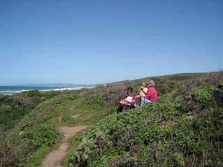
The day was sunny but a cool wind blew off the Pacific, and we bundled ourselves in sweaters as we walked along the bluffs above Pescadero Beach. There are bluffs above the tide pools, and from their heights we watched about twenty sea lions, all fat and glossy, lumbering around and sunbathing on the rocks.  

Just across the highway is the Pescadero Marsh Natural Preserve, at the confluence of Pescadero Creek, Butano Creek, and the Pacific Ocean. According to one source, its 640 acres make it the biggest marsh between Monterey Bay and San Francisco. There are three relatively short trails to explore: North Pond, Sequoia Audubon, and Butano Marsh.   

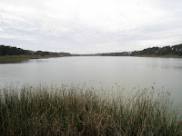
We randomly chose Butano Marsh Trail, which starts at a small, grassy parking area just a quarter mile up Pescadero Road on the left-hand side. A small sign marks the way.  The hike is only about a mile loop, and mostly flat, the highest elevation being 100 feet above sea level. Turns out, the marsh was intensely beautiful with mirror-like water, blooming flowers, and birds; plus, it was devoid of people except us.

The trail meandered downhill through bushes that grew taller as we approached the water. Birds sang in the branches—apparently there are around 250 bird species here, although we only recognized the bright blue, noisy scrub jays. (Some birds to look for include diving ducks, great blue herons, spotted sandpipers, godwits, snowy egrets, and yellow-throated warblers.)

We crossed a little bridge and went onto an old dike, continuing on the serpentine path above the water and cattails. It looked like someone had been building this dike up with driftwood and planks.  Jeannie has been taking a yearlong course in permaculture and had just learned about the making of hedgerows. She pointed out the small hedgerows piled along the sides of the dike, made with wood that had washed up there. “They are created by taking all of the dead wood in the space and piling it high, in a row, and preferably on contour to the land,” she told me, and then explained that hedgerows create “animal sanctuary space by giving protection, places to perch or burrow.” The animals eat and poop in the hedgerow and, she continued, “What happens over time is the local flora is introduced, and the animal population increases, and a little land has been healed.” In the end, the topsoil is built, the hedge nourishes the crops planted along it, and less runoff enters water sources.  

This was the most magical part of the hike, as the path became crowded with bright yellow flowers blooming at chest height. It reminded me of something from the Land of Oz. We guessed the golden, four-petaled flowers were wild radish because they looked like the ones growing in the empty lots of San Francisco except for the color of the blossom, which is purple and white in our city. They grew so thick along the dike that we had to part them before walking forward. All around, birds called and swooped and glided, and yellow motes of pollen twirled in the air.

Later we went to the small town of Pescadero to get lunch. We tried to get bowls of artichoke soup at Duarte’s Tavern, a Portuguese restaurant founded in the late 1800s, but the wait was interminable. So we walked down to the Country Store where two elderly men sat in the booths, and ordered lunch: corn chowder, salad with fresh lima beans and other vegetables from a local garden, a sandwich, and scooped ice cream for dessert.
 
I highly recommend exploring the Butano Marsh Trail before the flowers disappear later this season. The combination of golden blossoms, still water, birds, and the proximity of the ocean make this a unique place—I’m sure it’s beautiful any time of the year, but the flowers won’t last forever.


 RESOURCES

Pescadero State Beach—current weather, more info 

Pescadero Marsh—trail map 

Pescadero’s Website—the happenings in town, tide charts, places to stay and eat at 

Pescadero Marsh Natural Preserve—printable map, more info 


View Larger Map

Saturday, March 27, 2010

Russian Ridge: wildflowers, headwaters, and ancient oaks


Last weekend my husband, baby, and I went to Russian Ridge, noted to be one of the top five places in the Bay Area for seeing spring wildflowers. It’s a 1,978-acre park along Skyline Boulevard, or Highway 35, on that western ridge above Silicon Valley. It’s only 45 miles south of San Francisco, but neither of us had been there before.

It’s a truly beautiful preserve: sweeping, green mountain sides falling into ravines dark with trees and wet with streams; views go to the ocean without a house or road in sight once you’re on the trail.

There are around 10 miles of trails at Russian Ridge, but the loop we took was just three miles, easy enough for a baby in a sling or a small, walking kid. There are connecting trails to Skyline Boulevard that can shorten the hike to a mild one-miler if we had wanted that.

We walked a loop made up of three trails: the Ridge Trail, Hawk Trail, and the Ancient Oaks Trail, in that order.

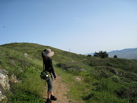
The single-track path led onto the ridge going north, and then curved down a hillside round as a pregnant belly. There were all sorts of colorful little flowers—we wished we knew the names beyond the recognizable lupines, buttercups, and poppies, which were lovely with their bright purple, yellow, and golden-orange colors, respectively.

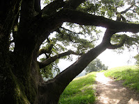
Huge boulders protruded out of the hillsides. Two tall snags were riddled with holes; an acorn woodpecker with distinctive white bands on its wings flew up and knocked around on one trunk. Red-tailed hawks soared overhead. A stream burbled as we descended the ridge onto the Hawk Trail; the headwaters of the Mindego and Alpine Creeks are here. Moss-covered buckeye trees had just burst forth their leaves, shiny and new, a brilliant green. The oak trees were impressive looking, truly ancient with thick, gnarled limbs and mossy bits on their stout trunks. They seemed to embody a quiet fortitude and had an indescribable presence, something out of Tolkien’s Fangorn forest. Even the baby seemed at a loss for words.

Notes:

Ø  Skylonda, a mountain community, has food and water at the junction of Skyline Boulevard and La Honda Road: Alice’s Restaurant, Skywood Trading Post (a convenient store and deli), and Mountain Terrace Restaurant. Hundreds of motorcyclists congregate here on the weekends. If you’re like my husband, you’ll need to stop here, put your baby in a sling to look real tough, and go ogle the bikes, looking for Ducatis, Triumphs, Hondas, and maybe an old BSA from the ‘50s. There are also two stinky port-o-potties in the central parking lot for anyone’s use. 

Ø  Mountain lions have been seen on Russian Ridge. I believe they keep to themselves, but if you encounter one the general advice is to appear large, make noise, and keep eye contact. The Mountain Lion Foundation has more information.

Ø  Besides a spring afternoon, other especially exquisite times to hike Russian Ridge include sunset and evening hours, and in late autumn when the hills are golden colored.


RESOURCES

Midpeninsula Regional Open Space DistrictRussian Ridge information, guided hikes, and a printable trail map

Virtual Maps—a colorful trail map of Russian Ridge

California Wildflowers—look up flowers by their color, family name, Latin name, or common name

Bay Area Wildflowers—look up flowers, herbs, ferns, grasses, and shrubs by category and photo


Please give suggestions for hikes, anecdotes, or feedback in the “Comments” section below, or send an email to jericahahn@hotmail.com.
  
If you like to hike with kids or babies, consider a subscription to SF Hiking with Children at examiner.com.


View Larger Map

Friday, March 26, 2010

San Bruno Mountain’s Summit Loop Trail: mountain lion and wildflowers!

Marshall got off work early by a couple hours on Tuesday, so I picked him up from downtown San Francisco and we drove to San Bruno Mountain, just south of the Daly City border. We’d try a new path for us, the Summit Loop Trail, a 3.1-mile journey circling the top of the mountain.

San Bruno Mountain is one of those places close to The City that also feels far away because it has wild animals, rare plant species, and the feeling you could almost get lost. (It’s absolute insanity that developers once considered chopping the top of the mountain off to use as landfill!) It’s a five to ten minute drive from downtown San Francisco, and walkable from Daly City, where I used to live.

The mountain is located at the northern end of the Santa Cruz Mountain range and peaks at 1,314 feet with views in every direction— Mount Tamalpais to the north, Mount Diablo to the east, hills and mountains of the southern peninsula, and the Pacific Ocean to the west, where the horizon traces the curve of the earth. Deep ravines fissure the sides of the mountain and create all sorts of mini ecosystems, harboring at least fourteen endangered plants and butterflies.

We parked at the second lot, beyond the underpass, put the baby in a sling that her daddy wore, and started walking up the mountain on the Summit Loop Trail, quickly leaving behind a grove of eucalyptus trees clustered around the parking lot. It was late afternoon but still sunny.

The trail switchbacked a mile to the peak, but the elevation change was gradual. A child could manage this. As this was the north side of the mountain, the plant life was dense with bushes and the wildflowers were like colored bits of confetti on either side of the trail.

Suddenly Marshall spotted a large, golden-colored cat about 150 yards away, across a ravine! I’ve never seen a mountain lion before, and if this was one, it was a juvenile male as he sauntered in the open, his long tail quivering as he sprayed some bushes. He looked about 2-3 feet long, with a tail of equal length, and appeared much like a lioness. His golden pelt contrasted with the green bushes. We watched as he walked downhill, sprayed, crouched to pounce at something in the grass, and then pad along another trail (we think it was the Dairy Ravine Trail). We talked about what to do if we saw a mountain lion right before us: make ourselves look big, slowly back away, holler and yammer. But maybe it was just a Perry the Refrigerator of a housecat. If it was a mountain lion, I feel blessed to have seen one.

Nonetheless, I later contacted San Bruno Mountain Watch, and they directed me to contact the ranger, Mr. Albert Zucker. Apparently, a mountain lion was sighted on San Bruno Mountain just a month ago. Two years ago, CBS really blew news out of proportion about a lion on the mountain, acting as if a serial killer was on the loose; a more levelheaded article from The Examiner pointed out that species might be returning, including a rare deer. We would only be so lucky to have our wild animals come back. And the wild animals, may they survive and live long lives on the mountain, considering they’re surrounded by a sea of concrete, traffic, and aggressive human beings.

We continued up Summit Loop Trail and crossed the emergency access road twice at the peak, where there are some radio towers. From then on the trail gently meandered two miles downhill, going into a ravine with a creek, April Brook, flowing through it. The flora changed depending on the exposure—we saw Indian paintbrush, ceanothus, coffee berry, and California poppies, purple irises, many different kinds of lupine, umbrellas of angelica, willow trees, and lots of poison oak, very fresh and oily.

On our final leg, Marshall found an old, spent bullet on the trail. Idiots with guns are much scarier than any mountain lion.

We returned to the parking lot an hour and a half after we’d begun. It was close to sunset and there was a marine wind beginning to blow in. The baby had been awake and happy for most of the hike, but had fallen asleep, as she’s wont to do by the end of a hike, and we felt good. In all, Summit Loop Trail was truly beautiful, isolated, and accessible. Highly recommended!


Note: There’s a $5 parking fee, or buy a yearlong San Mateo County Park Pass for $60.


RESOURCES

San Mateo County—San Bruno Mountain webpage has a printable trail map, hours, info on volunteering, and all that good stuff.
San Bruno Mountain Watch has an impressive amount of information about the flora and fauna, restoration, and group hikes.
Mountain Lion Foundation


For succinct articles about local hikes that are good for kids, consider a free subscription to SF Hiking with Children at examiner.com.


View Larger Map

Tuesday, March 23, 2010

Fort Mason Park: a magical tree and blooming flowers

Just south and east of Fort Mason is a park with a magical tree in its center—the tree’s wood is gnarled and pitted, the branches blown into arcs that touch their leaves to the grass. There’s something about this tree capable of drawing children into its branches where they discover something that looks like a bed, or a table, or a bench, all the while getting a view of the Golden Gate Bridge in the distance. See for yourself.

Although this park is mostly rolling, grassy fields, wildflowers bloom this time of year. The grass is studded with galaxies of bright yellow oxalis (sour grass) and white daisies. The southwestern-most edge of the park has huge, blooming bushes of blue-colored ceanothus flowers and lavender-colored butterfly sage, fragrant and buzzing with pollinating bees. Ceanothus, by the way, is a California native that the Miwok people drank as a tea during childbirth (more details here).


Baby and Kid Notes

This is the kind of park that’s perfect for sunning babies’ bottoms on a warm day. An enormous statue of a woman and her child seems to watch over the whole park and lend a particularly child-friendly atmosphere. There’s a public restroom, next to a cordoned off area where native plants are blooming. The three-year-old who accompanied me on the discovery of this park ruefully noted there were no playgrounds here (although she happily clambered all over the “magic” tree).
Other Details


A long staircase in the northwest corner of the park leads to Fort Mason, where there’re often festivities during the weekend (like the Young Performer’s Theater doing a version of Willy Wonka through March 28), as well as weekly classes for kids and adult (i.e. art, music, tai chi, theater). See Fort Mason’s website for all the details.

From the northeast section of the park, it’s a short walk to Aquatic Park where there’s a stretch of sand to play in, visit Ghirardelli Square for free chocolate samples, or go the mile to lollygag at Fisherman’s Wharf.


View Larger Map

Monday, March 22, 2010

The Alemany Farmers' Market


The Alemany Farmers Market, known as “the people’s market,” is not to be missed with its organic produce, vegetable and herb seedlings for sale, hot, prepared foods to eat, buskers playing steel drums, and good people. It happens every Saturday, 8 a.m. to 3 p.m.

Apparently it was the first farmers’ market in California, founded in 1943, but that’s hard to believe since farmers have sold goods at markets for a long time. Regardless, it’s established and well loved, and definitely worth patronizing.

It’s accessible by bus and car, located at 100 Alemany Boulevard, at the confluence of the 280 and 101 freeways in southeastern San Francisco, and directly south of Bernal Hill. Parking is free.

It’s a nice idea to avoid plastic—bring cash and your own bags.

One of the best aspects to the Alemany Farmers’ Market is its proximity to a great urban hike—it’s literally on the southern edge of Bernal Hill, one of the prettiest places in San Francisco.


View Larger Map

It's Spring! Yay!


Spring is here! On Saturday at 1:30 in the afternoon, the Sun crossed directly over the Earth’s equator and marked the Vernal Equinox, when day and night are of equal length. The Vernal Equinox occurs anywhere from March 20th to the 23rd—this year it was on Saturday, March 20th.
It's appropriate, therefore, to celebrate the arrival of spring by taking a hike on the green hills of the Bay Area, just now blooming with wildflowers.


Traditions

People have celebrated the Vernal Equinox for thousands of years. The Sphinx of Egypt gazes directly at the rising sun on this day. The Persian New Year, Nowruz, begins on this day. The first sign of the astrological zodiac, Aries, starts on March 21st—it’s the sign that contains all potential, like a seed about to sprout. Some British Isle pagans believe the earth quickens with certain energy during this time, which they called Eostre (long before Christians celebrated Easter). 

“The ancient trackways, the ridgeways, were said to be the backbone of the dragon,” writes British author Glennie Kindred; perhaps it is especially good now to walk the ridges of hills and mountains—Skyline Boulevard of San Mateo County, Mount Tamalpais of Marin, Twin Peaks of San Francisco.

Winter is over in the northern hemisphere. Plants are sprouting new leaves. Flowers bloom, eggs hatch, animal babies are born. The equal length of day and night recalls the Chinese yin and yang symbol of dualities: male and female, hot and cold, dark and light.

It’s a good time to start a garden, or just get out among the wildflowers.

Enjoy the season!


Saturday, March 20, 2010

Lake Merced of San Francisco


At the southernmost point of Lake Merced in San Francisco is a bridge connecting one side to the other. I decided to explore the bridge, see what I could see, and walk around the bottom part of the lake. It was near sunset and I was tired, so this was more of a short reconnoitering than a hike.

The first sounds I heard upon leaving the bubble of my car: gunshots and honking cars. Apparently there’s a gun range, and endless cars zooming down the thoroughfares on all shores.
 
Undaunted, I hoisted the baby into a sling and looked for nature.


The Baby Factor

Gunshots and racing cars aside, this is a lovely place to walk your baby. The lake is gorgeous, the air is crisp and marine, and the trees—what there are—are tall and green. A paved path meanders with the perimeter of the lake, roughly 4.5 miles. There are picnic tables, grassy areas (not just the three golf courses), barbeque pits, plenty of parking spaces, and public restrooms.

But at the bottom line, gunshots and traffic are a drag (Note: Pacific Rod and Gun Club releases its racketing volley on Wednesday, Saturday, and Sunday).

 
The Walk

Nature signs directed me to look for white-crowned sparrows in the coyote brush growing along the banks of the lake. I couldn’t see them. I listened for their “distinctive song, ‘I-I-I gotta go wee wee now!’” I really would’ve liked to hear that song, but there was a fusillade in the background.

In the summer, the coyote brush blooms pale flowers that butterflies feed from. That would be nice to check out. 

Cross the southern bridge where fishermen cast their reels and rowboats push through the water, and watch the ducks. And pigeons--lots of them swooping overhead in flocks. Note the marshy flora and consider that Lake Merced is freshwater, fed by an underground spring, and used to be San Francisco’s drinking source until Hetch Hetchy was made (and possibly could be an emergency drinking source for the City). Try walking around the lake, but avoid rush hour.  


Friday, March 19, 2010

Bolinas: a loop from downtown to the beach


No signs lead to Bolinas, so it’s difficult to bumble upon this seaside village. In the spirit of day tripping, Bolinas is a beautiful, quiet place to bring a baby or a child, especially mid-week when there’s less of a weekend crowd, as it’s no secret hideaway in the age of GPS. 


The Baby Factor

The one-mile loop is easy for small kids and babies in slings, and the beach is expansive, with plenty of room for running and playing. Keep in mind there’s no shade on the beach.

There are few lunch options besides picnicking. Kids might appreciate the Coast Café with its high chairs, crayons, chalk for using on the patio tiles, and Raggedy Ann dolls. Parents like the organic food grown within 25 miles of Bolinas. Next-door is the Bolinas Market, with tables and a grassy area behind the store.


The Details

Start on downtown’s main street, Wharf Road, at the library, the Bolinas Market, or the Coast Café, for food, water, and the bathroom. Walk east on Wharf Road towards the mountains, passing crab fishermen at the muddy flats, a boat club, a gallery, a hotel, and dozens of houses perched over the water on stilts. Wharf Road dead-ends at a rocky jumble where the Pacific Ocean meets Bolinas Lagoon; a salty old bench faces the sea and a leg of land from Stinson Beach.

Hug the shore to get to the wide beach—there’s about a hundred feet where land and sea merge. High tide makes the path impassable for children; your hike’s shape will be a horseshoe rather than a loop.

The beach is wide and sandy, strewn with flotsam in its upper reaches, decorated with driftwood, and bordered by a steep hill covered in greenery. Kids play naked, surfers ride waves, and women sunbathe.

A concrete ramp with graffiti-covered sides leads to Brighton Avenue, a street that connects with Wharf Road and downtown Bolinas. During high tide, enter the beach here.


Tuesday, March 16, 2010

Sunday Streets: No Cars, Just People on the Embarcadero


Sunday was a beautiful day with the sun shining on the Bay Area and such good air quality that the silhouette of Mount Diablo stood out clearly on the eastern horizon, even from my vantage point in San Francisco. Best of all it was a designated “Sunday Street” day, where San Francisco shuts down a long section of road to motor vehicles, opening the street for pedestrians, bicyclists, strollers—anything powered by legs, feet, and hands.

The selected stretch was mostly along the Embarcadero, starting in quiet China Basin, south of the ballpark, all the way to frenetic Pier 39. From end to end it was 3.8 miles. Even if the streets weren’t closed to cars, the walk is great with a constant view of the bay and the Oakland hills in the distance. There are green, grassy spots and play structures along the way for the children, public restrooms, and some cool, funky restaurants. As well, much of the route was part of the historic Barbary Coast Trail.

We began our walk at Mariposa and Illinois Streets, essentially on the backside of Potrero Hill.  My husband and I brought our baby in a stroller, and took sunhats, water, and carrot bread with my friend Jeannie’s homemade blood orange marmalade. Mariposa Street turns into Terry A. Francois Boulevard, curving along a waterfront, juxtaposing fishermen on old docks with razor wire on cyclone fences. But it was cool, immediately seeing people on bikes in the middle of the road. We’re so used to being watchful for cars, it took some time getting used to being in the middle of the road.

In the distance was the Bay Bridge. We mused, if we make it there, that’d be great. We didn’t think we’d walk all the way to Pier 39.

We walked on down Terry Francois Boulevard to where it doglegs to the left at Pier 48, the first green, grassy patch. Children were shrieking and sliding and jumping in an inflatable, plastic castle.

The route then connected with 3rd Street, at Mission Creek, locally known as Shit Creek, as least by my old-time San Franciscan friends.  We crossed the 3rd Street Drawbridge, my husband musing about what it would be like to live in the tiny office above the road.

The route continued along Willie Mays Plaza, on the cold side of the ballpark, but we hugged the water’s edge on the Barbary Coast Trail, named for the old red-light district in the days of the 49ers, now a trail made of concrete. Whooshing by came a bald and bearded man, his bike weaving happily, his sound system blaring a song by Musical Youth:

It was a cool and lovely breezy afternoon
(How does it feel when you've got no food ?)
You could feel it 'cause it was the month of June
(How does it feel when you've got no food ?)
So I left my gate and went out for a walk…

He was the Pied Pipers of bicyclists, with a throng behind him, including a Burner woman in hot pink, blowing bubbles.
Pass the Dutchie on the left hand side
It a gonna burn, give me music make me jump and prance…

I saw a homeless man turn and stare, and when he looked back, he was smiling. And all along the east side of the baseball stadium was a long, rectangular waterside park with tall, rustling trees. We stopped for a diaper change and hoisted the baby onto a sling I carried.

The rest of the walk was the Barbary Coast Trail, running parallel and just east of the Embarcadero. The northbound lane of the street was closed to motor vehicles. Now people were out en masse.  Martial arts practitioners flipped each other around at the diamond-shaped Rincon Park, also known as Cupid’s Span because of the enormous sculpture in the middle of the lawn of Cupid’s arrow piercing the heart of the City.  


We stopped at Tcho, a chocolate company, and tried free samples, preferring the darkest chocolate. We wandered through the Ferry Building, loving the smells of cheese and coffee (there’s a public bathroom here, by the way).  We meandered down the open road, noticing that anyone with a sound system strapped to their bicycle invariably had a following of people behind them—everyone likes a song. And more power to the busker’s on the sidewalks! There was even a band of kids, Exit to Rock, belting out Clash and Ramone’s covers.

Finally, just as the Embarcadero was opened to motor traffic at 3:00 in the afternoon, and the wind was beginning to blow, we reached Pier 39 and the Aquarium of the Bay. We sat and ate the last of our carrot bread, savoring the delicious marmalade. When we were leaving we noticed a modest playground, right alongside the water.
 
We decided to walk the whole way back, although we were tired and the baby got grumpy. We stopped for a rest and a bite at a very cool diner on the water, Red’s Java House, just south of the Bay Bridge. The homemade chili and beans, topped with huge chunks of cheese and wedges of yellow onion, was under $3; the cheeseburger bun was a fair hunk of San Francisco sourdough. I met a young, very pretty woman in line for the bathroom, drinking Pabst Blue Ribbon, who yammered about the great price of beer. “You can get a bucket of six beers for cheap!” she shrieked.
 
By the time we got back to where we began, our dogs were barking, the baby was sleeping in the stroller, and a crisp wind was blowing. We were still excited from the walk—that we went the whole route and back, the discovery of some places new to us, and the fact that there are a half dozen more of these car-free Sundays to come.


What and Where?

Sunday Streets Website

Tcho Chocolate

Red’s Java House
Pier 30 (Bryant & Embarcadero)
(415) 777-5626
http://www.yelp.com/biz/reds-java-house-san-francisco

The next Sunday Street is April 11th, going along the Great Highway and through Golden Gate Park.