Hill Babies Special: Shasta Lake, California
Perhaps you've noticed Shasta Lake on a drive up the I-5 freeway, about three-fourths of the way to the Oregon border. There's a bridge that crosses over it, and the man-made lake spreads out like wings or fingers on either side of the bridge, the water a deep dark blue. Once there were four tributaries here--the Sacramento, Pit, and McCloud Rivers, plus Squaw Creek--but the dam turned this area into a reservoir for California's agriculture.
These days the water is low and a red earthen belt shows between the tree line and the water's surface. The missing water is the elephant in the room--where is it? Evaporated? Drunk? Spilled on lawns and golf courses? Until I came up here for a long weekend, I didn't think much about Shasta Lake. If the drought didn't mean much before, except warnings through social media, then here is where you can really see the level for some of California's diminishing water supply.
According to some of the locals I spoke with, the water level shouldn't deter you from coming here. It's true--with low water levels, you can get on a boat and see rarely-exposed Southern Pacific railroad tunnels and mining towns, like Kennett which appears when the water level falls 150 feet below the dam. You can sift for crystals and fossils. You can fish. You can hike, swim, and go inside a mountain. There's gold in the creeks. There's a Chinese mining camp, and evidence of the indigenous people, the Wintu. There are fossils of prehistoric insects, coral, leaves, and critters. There are beaches and waterfalls.The locals who chatted me up seemed certain that eventually the water level will rise again.
In the 19th Century, miners from around the world flocked to this area, excavating veins of gold, silver, and copper, and built towns along the tributaries. One town, Baird, cultivated salmon sustainability with its federally funded Baird Fish Hatchery, where
they collected millions of salmon eggs to keep the river stocked.
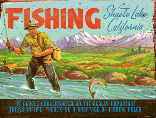
 From all accounts, there are a lot of fish in Shasta Lake, and this is a fisherman's paradise. One local told me he could catch thirty to forty trout in a few hours--all different kinds too: rainbow, brown, you name it. He described three types of bass: large mouth, small, and spotted. Crappie. He talked about a mythical twenty foot long sturgeon (but apparently the record states the longest is 7 feet, from 1977).
We passed low trees of mazanita, with its stiff, coin-like
leaves, and more noticeable, the smooth patches of bark that look like dark
maple syrup dripped over the branches. Mike told us about the Wintu’s use of it
as a tea, using leaves and bark. Apparently the concoction closes your pores,
and helps in relieving dermatological issues, even preventing poison oak. And
if you did have a wicked rash, a salve made of Manzanita can clear it in one to two days. “You can find bottles of
it at health food stores,” Mike told us, “called Manzanita Magic.” Sure enough,
later I found it for sale online.

GENERAL INFORMATION (i.e. water level, water and air temperature, etc): www.shastalake.com
WINNEMUM WINTU: http://www.winnememwintu.us/who-we-are/
LIMESTONE AND CORAL ISLAND PROCESS: http://www.rockdetective.org/~rockdetective/pdf/BLOGQ.pdf
 |
| Shasta Lake, McCloud Arm. Photo by Roger Taylor |
These days the water is low and a red earthen belt shows between the tree line and the water's surface. The missing water is the elephant in the room--where is it? Evaporated? Drunk? Spilled on lawns and golf courses? Until I came up here for a long weekend, I didn't think much about Shasta Lake. If the drought didn't mean much before, except warnings through social media, then here is where you can really see the level for some of California's diminishing water supply.
According to some of the locals I spoke with, the water level shouldn't deter you from coming here. It's true--with low water levels, you can get on a boat and see rarely-exposed Southern Pacific railroad tunnels and mining towns, like Kennett which appears when the water level falls 150 feet below the dam. You can sift for crystals and fossils. You can fish. You can hike, swim, and go inside a mountain. There's gold in the creeks. There's a Chinese mining camp, and evidence of the indigenous people, the Wintu. There are fossils of prehistoric insects, coral, leaves, and critters. There are beaches and waterfalls.The locals who chatted me up seemed certain that eventually the water level will rise again.
 |
| Shasta Lake. Source: silverthornresort.com |
*
SHASTA LAKE HISTORY
 |
| Source: palaeos.com |
The unique geology of the hills around Shasta Lake come from a Devonian Age coral reef, 360 to 400 million years ago. The reef was slowly conveyor belted along on a tectonic plate that smashed into the heavier North American plate, pushing up mountains of limestone. Once the water receded, deep fissures between the mountains became pathways for three great rivers.
 |
| Source: www.winnememwintu.us |
Fast forward to the time of humans, when the Winnemem Wintu, the Middle Water People, lived here. Their homelands centered around Mount Shasta and the McCloud River, but their tribes went as far south as the San Francisco Bay.
"We were born from the water, we are of the water, and we fight to protect it," says the official Winnemem Wintu website. (Though recognized by the US government in the 1850s, their tribal status was unrecognized in the 1980s, which denies the Wintu many rights.)
 |
| Water claims the town of Kennett |
Shasta Dam was built between 1938 to 1945. Engineers claimed it would take a decade to fill the valleys, but in one year the water submerged sixteen mining towns, and ninety percent of Wintu land and sacred sites (see here).
 |
| Shasta Dam aerial panorama. Source: Peter Essick, Nationalgeographic.com |
*
FAUNA
 |
| Osprey nest. Photo by Roger Taylor |
We saw osprey flying, and their huge
nests on the tops of electric transmission towers, and plenty of turkey vultures. At night, sitting on the deck of the Bridge Bay Cookhouse, come brown
bats appeared at dusk. If you toss a tiny pebble in the air, they dive for it,
their already erratic bug-catching flight patterns a zigzag of butterfly-like
movements. Squirrels chittered
around the trees, delighting our kids.
Though we didn’t see the following, this area is home to black bears, black tail deer, bobcats or
mountain lions, jackrabbits, red-tail fox, skunks, bald eagles, golden eagles,
blue heron, quail and a whole lot
more.
*
FLORA
 |
| Ponderosa. Source: wikimedia |
Ponderosa pine
seems to be the dominant tree, and it has noticeable bark: fragrant, fissured,
and thick horny plates like a turtle’s shell. “Three dimensional,” said Mike,
the silver-bearded bus driver at Shasta Caverns. Black Oak is also prevalent.
Mike continued describing plants as he drove the shuttle towards the caverns. He said about poison oak leaves: “See three, leave it be,” and “If it’s shiny, watch
your hiney.” Some of poison oak’s green, slick, tri-lobed leaves were turning
red, which happens as the plant dries out to conserve water, and the year progresses towards fall.
 |
| Buckeye. Source: laspillitas |
Mike pointed out buckeye,
a native tree that has “corncob-like blooms, six to eight inches
long, that look like bottle brushes.” The Wintu people would grind up a part of the plant and sprinkle the grains on the water, which would temporarily
paralyze fish. “In a few
minutes,” Mike said, “the effect wears off the fish and they swim away.”
Apparently Fish and Game has made this form of fishing illegal—it’s too easy.
“It’s like fishing with explosives!”
*
LODGING
Literally staying on the lake in a boat seems like a great option, but not for me, not yet with two year old twins. I hate to admit that I don't want to camp with them either--I've done it and it is so much work, it doesn't feel like a vacation. The best option for my young family of five is a cabin-like setting, with a kitchen.
 |
| Bridge Bay. Photo by R. Taylor |
We stayed at Bridge Bay at Shasta Lake in one of their Kitchen Units. It was just right for our weekend: spacious, a big bed, a fold-out futon, a kitchen with all the kitchen tools, an outdoor BBQ area with our own picnic table, and we were situated right above the swimming pool.
Bridge Bay has four other types of rooms, running the gamut from motel-style to the large Kitchen Super Suite, that accommodates two families and saves you a little more money.
One day when my kids are older, I'd love to stay on the lake in a boat. For now, sturdy walls and a kitchen are what I need, and Bridge Bay's Kitchen Unit was perfect for our needs. For rates and more info, click http://www.bridgebayhouseboats.com
*
EATING
 |
| View from the CookHouse. Photo by Roger Taylor |
Since I stayed at Bridge Bay, it helps that there's a good restaurant on the property, the CookHouse. The kids' plates are substantial, and priced right, like $4 for the Hungry Angler: bacon, egg and a piece of French toast. The $5 kids burger, with fries and fruit, could satiate a grown man. They have inside and outside seating, all perched above the lake with great views. The only drawback is the slow service, but if you sit outside, the kids can be distracted by the view of the lake, the I-5 bridge, freight trains and trucks in full view, and little brown bats flitting into the air at night. (You can also ask for oyster crackers if the waitstaff haven't already brought out hot bread and butter)
Safeway in Redding is a 15 minute drive from Bridge Bay, so that's another eating option. Think of going to Shasta Lake like you were going camping, and your expectations will be exceeded.
*
SHASTA CAVERNS
 |
| Inside Shasta Caverns. Source: Roger Taylor |
These caverns have to be one of the star attractions to the area, but when we visited, the gift shop was kind of like a ghost town, the rush of summer over. If you're driving north on 5 from Bridge Bay at Shasta Lake, exit on O’Brien/Shasta Caverns Road. The narrow road winds downhill, Manzanita growing on the soft shoulders, the hill steep and tree covered. Turkey vultures soared overhead.
You buy tickets at the gift shop, and they are not cheap—tots under two, and babies are free, otherwise tickets for kids cost $14 each, and adults $24. Still, the tour included a ferryboat to the other side of the water, a bus chugging 1.5 miles up a mountain road, to 800 feet of elevation, the lake like
blue silk between the trees in the distance. And the climax: an hour-long tour
in an underground labyrinth, glittering with crystals and festooned with
stalagmites.
Our bus puttered up a steep road with no guard rails, the
driver chuckling about anyone afraid of heights not peering out the right-side
windows. Remember the mining towns submerged by the water behind Shasta Dam?
Mike pointed out Baird would be in
the water below and behind us. In 1877 one of the Baird Hatchery’s employees
was hiking around the mountain above town when he discovered some caves, later named Shasta Caverns.
You spend about 45-minutes inside a labyrinth of caves, going through rooms glittering with crystals, ceilings hung with stalactites, and spiky-floored with stalagmites. It's absolutely beautiful.
However, one of my twins freaked out and had the tantrum of her life inside. We were stuck with the group, and the tour continued on as my kid screamed and cried and bit her dad who was carrying her. So maybe think twice about this tour if you have a toddler. I think a two-and-a-half year old is cognizant enough about self-preservation to get scared by a tunnel, but not knowledgeable enough to know the sunshine is just down the corridor.
However, one of my twins freaked out and had the tantrum of her life inside. We were stuck with the group, and the tour continued on as my kid screamed and cried and bit her dad who was carrying her. So maybe think twice about this tour if you have a toddler. I think a two-and-a-half year old is cognizant enough about self-preservation to get scared by a tunnel, but not knowledgeable enough to know the sunshine is just down the corridor.
 |
| Sluice at the caverns shop |
After the tour and back at the starting point, Shasta Caverns gift shop, I discovered the store was pretty cool with a natural
history focus. I bought my daughter her first
slingshot, wood carved like a stag, and a $5 sack of rocks that she
filled herself from a box of crystals, including rose quartz
the size of a man’s thumb.
The Shasta Caverns Playground
was impressive too—replete with a crooked log cabin, climbing tunnels, and a water
sluice where kids can pan for tiny iridescent crystals—calcite,
peridot, obsidian and amethyst to name a few—to take home. Picnic tables are arranged in an oak-shaded lawn area.

*
*
*
EASY HIKE: BAILEY COVE
This hike is basically the 2 mile flat trail along the perimeter of a little peninsula just below Bailey Cove. To get there, you take the same exit off 5 that you would for the Shasta Caverns, O’Brien/Shasta Caverns Road. You drive down the single lane road until you see a pull off for Bailey Cove, and park in the parking lot nearest the water, where you'll find the trailhead.
The one drawback to this hike is the narrow trail coupled with low water levels, because if you have any sense of vertigo, the steep drop-off might trigger it. I wanted my twins to stay in their double stroller, and that made walking a hell of a lot less fun.
However, slightly older children, like my five-year-old, loved it. She could've gone around the whole peninsula, but since her parents turned around a quarter mile into the hike, sweaty and tired from navigating a heavy stroller over root clumps and between poison oak, she turned around too.
*
FINAL THOUGHTS
A long weekend was not enough time for exploring Shasta Lake, though two days was a great introduction. I plan to return, and also look forward to when my children are older and more independent so I'll feel confident about overnighting on a houseboat. I recommend this area for people with kids, and if you have two year old twins, getting a room like I did, next to a pool and a restaurant, right on the lake, near to the Caverns and easy hiking, is a good way to go.
SOME LINKS
WINNEMUM WINTU: http://www.winnememwintu.us/who-we-are/
LIMESTONE AND CORAL ISLAND PROCESS: http://www.rockdetective.org/~rockdetective/pdf/BLOGQ.pdf
BRIDGE BAY AT SHASTA LAKE: http://www.bridgebayhouseboats.com
BRIDGE BAY COOKHOUSE: http://www.bridgebayhouseboats.com/amenities/dining/
SHASTA GEM AND MINERAL SOCIETY: http://reddingblogs.com/shastagemandmineralsociety/
SHASTA GEM AND MINERAL SOCIETY: http://reddingblogs.com/shastagemandmineralsociety/


