"All good things are wild and free." --Henry David Thoreau

Tuesday, July 17, 2012

Fitzgerald Marine Reserve: where the seals come to do some people watching

So your child wants to see animals up close and personal? There's not much better than being on a beautiful seashore half an hour south of San Francisco with incredible tide pools at your feet, and a herd of harbor seals writhing with pleasure on the sand a hundred yards away.


Fitzgerald Marine Reserve in Moss Beach has been a designated plant and animal haven since the late Sixties, and subsequently over two dozen marine species have been discovered here. In terms of discovery, I couldn't believe I'd never been here. What a cool place! I love seals, tide pools, the ocean, and all of that also being close to home. 
The tide pools are chock full of seaweed, anemones, sea stars, crabs, sponges, and fish. A friend of mine actually found an octopus once, she told me. A huge group of seals were farting and grunting on the beach, cool as could be, and so exciting---you just have to stay 100 yards from them (park rule), though lots of them were swimming alongside the shore, quite close with their doggy heads peering out of the water, checking out all the humans.
HIKING
To get a walk in, cruise along the bluffs on a mile's worth of trails, or ride a bicycle several miles down the California Coastal Trail, all the way to El Granada if you like, where there are plenty of sweet restaurants (Ketch Joanne is my favorite) and picnic places.


TIDES
Before visiting Fitzgerald Marine Reserve, make sure to check a tide schedule to arrive during the lowest tide:www.Saltwatertides.com.
LAST NOTES
Keep in mind the park opens at 8 am. Dogs are only allowed on certain trails, and not around the tide pools or the marine animals.
FITZGERALD MARINE RESERVE
200 Nevada Avenue Moss Beach, CA 94038 San Mateo County
(650) 728-3584 Park HQ (650) 363-4021 Group Tours

View Larger Map

Saturday, July 14, 2012

CANDLESTICK POINT STATE RECREATION AREA

Fog coming over San Bruno Mountain at sunny Candlestick Point
How many people know there are beaches in southeastern San Francisco? Candlestick Point State Park has 252 acres with not only beaches, but trails, more picnic sites than you can shake a stick at, meadows, piers, and is as relaxing and beautiful as any park situated next to a great blue body of water. It’s such a cool place that you might consider it a necessary destination. 

Windsurfers use the park as a starting point for their forays into the chop, fishermen cast reels from the pier, families have picnics and barbeques, people walk dogs on leash, and bicyclists can cruise for miles. 
Photo by pier Kathryn Rodriguez
 I like to park at the main lot off of Hunter’s Point Expressway, or at the Last Port lot on Harney Way. A trail leads between the two lots.

Percussion! Pic by K. Rodriguez
Each area is great to explore—find Hermit’s Cove, Windharp Hill, Sunrise Point, and an awesome set of permanently installed metal percussion instruments that kids can bang their hearts out on.

If you want to barbecue, it seems like there are dozens of sites to choose from. Almost every picnic area has a view of rippling water, a wind wall, grills, water spigot, garbage cans, a picnic table, and bathrooms within a short walk.
 
FLORA and FAUNA
This park probably has more animals than the average park in the city, hands down, because of the Bay, the proximity to large natural spaces such as Bayview Hill and San Bruno Mountain, and that this was/is marshland, which has a high amount of biodiversity. 
Cormorant; pic by K. Rodriguez


This park is also part of the Pacific Flyway, a major route for migrating birds during certain times of the year. Regular residents include crows, ravens, hawks, brown pelicans, seagulls, terns, egrets, and cormorants. Ground squirrels, skunks, and jackrabbits also consider this their home.

 Much of the flora isn’t native because it was planted on landfill, but you’ll find trees like coast live oak and buckeye, bushes like ceanothus and coyote brush, and the ubiquitous invasive edibles, wild radish and wild mustard. Candlestick Point has officially been a park since the late 1970s, but many of the plants look older.
Pic by K. Rodriguez
FUNDING ISSUES
Come soon. On a recent walk, two park rangers said, “Our schedule is literally month to month.” Despite decreased funding that has left the park understaffed and the parking lot closed on Thursday and Friday, bathrooms are open every day. And how do we keep our state parks from shutting down?!?

Kids on the beach at Candlestick Point

THE REPUTATION of the NEIGHBORHOOD
I'll say it---the reputation of this park and the Bayview neighborhood is ill deserved these days. It's crazy that so many maps in San Francisco cut off--literally omit--the southeastern portion of the city (the de Young Museum map in the observation tower, for instance). It's racist, unfair, and unjustifiable.

This is not directed at you, dear reader, it is just my rant now.

In my experience growing up in San Francisco, and now raising a kid here, acts of violence have been random and happen anywhere. Walking in the cities should be done with open eyes. Stay safe wherever you are by bringing a friend, your cell phone, and not living in a vacuum. Say hi to people you pass and help break down the damn stereotypes; they are so tiresome.   

View Larger Map


TIDE SCHEDULE
High and low tide are quite different, and low tide is pretty stinky, so plan your picnic, birthday party, or hike accordingly! You won’t find tidepools here during lowtide, but mudflats that smell gassy and fishy. 

USEFUL LINKS
Candlestick Point State Park Brochure (and best trail map) http://www.parks.ca.gov/pages/519/files/CandlestickPt.pdf

Pacific Flyway info (for bird-lovers)

Tide Schedule (high tide recommended)

Thursday, July 12, 2012

Chasing the Alpine Blue at Hetch Hetchy, Yosemite


HETCH HETCHY, YOSEMITE

I was always like, “Yeah, Hetch Hetchy—the place where the water in SF comes from.” But I’d never been there, until this summer.

Hetch Hetchy Reservoir
It’s incredible. I expected the quintessential Yosemite, a mashup of nature and mankind, and in a way Hetch Hetchy is, but walking along it’s northern shore was sublime, the kind of feeling that is almost religious, which says a lot for this atheist city slicker. Instead of humans all over the place, there were hundreds of teal colored butterflies, alpine blues, yellow and black swallowtails, and orange butterflies flickering over the rivulets moving down the granite walls of the valley and into the reservoir, a space so blue and flat and pristine, you almost start to plan a secret skinny dipping event for the next full moon. ;-) There are three great possible hikes from the Hetch Hetchy Reservoir, destinations being the dam itself, Wapama Falls, or Rancheria Falls.

THE TODDLER’S HIKE-- O'Shaughnessy Dam
On the trail
The walk along the top of the dam gives you a feeling of being on the wall of some American castle, and at the far end is a tunnel that a toddler would love to walk through. The dam is an undeniable engineering feat, constructed from 1915 to 1922, and happens to be in a setting so beautiful that John Muir fought tooth and nail to keep it from being built. The view is dazzling, as is the fact that Hetch Hetchy's water travels 167 miles more or less downhill by gravity, and serves more than 2.4 million people with clean drinking water. The tunnel at the far end, where dam meets the valley way, was dynamited out of the rock and it has the feeling of gnomes and magic, dripping with moisture and cooled by wind blowing through it. If you have rain boots for the toddler, bring 'em for stomping in puddles.
Wapama Falls

THE BIG KID’S HIKE--Wapama Falls (3 miles r/t)
The three-mile round-trip walk from the dam to Wapama Falls is plenty for kids, and you’ll need to bring water, snacks, and a hat with an extra wide brim. (In fact, I was fortunate to have a newborn blanket on me, pinned to my hat to keep sun off my shoulders). The trail winds up and down the valley’s edge on a trail that faces the sunny south, but the shade of oaks and bay laurels keeps you cool in moments, and otherwise you smell the aromatic sage, yerba santa, and the scent of hot granite in the sun.  

THE HIKER’S HIKE--Rancheria Falls (9 miles r/t)

En route to Rancheria Falls
The round-trip hike to Rancheria Falls is 9 miles (5.4 one-way from the dam), an all-day trip that eluded even my husband and I. We almost made it, maybe halfway where we came to green meadow with purple flowers and ponderosa pines, the wind warm, the place magical. Some people we passed were going to camp there; they had the right idea.

GETTING THERE
It’s about three and a half hours drive to Hetch Hetchy from San Francisco, and basically you go east through the Central Valley and towns like Oakdale, where you can buy big baskets of fruit grown in the local orchards. Hetch Hetchy is located on the northwest corner of Yosemite National Park, which is far less trodden than the main valley, FYI.


STAYING THERE
There is great lodging within a couple miles from each other: camping by a creek with your own “bear box” and flat tent site (Dimond-O Campground), cabins in San Francisco’s own Camp Mather, or deluxe accommodation with a restaurant at the historic Evergreen Lodge.

Trail between Wapama Falls and Rancheria Falls
Bee on lupine flowers
The O'Shaughnessy Dam
Hetch Hetchy Reservoir
Indian paintbrush


Monday, July 9, 2012

HIKE the VISITACION VALLEY GREENWAY on JULY 15, 2012

HIKE the VISITACION VALLEY GREENWAY on JULY 15th
Herb Garden of the Visitacion Valley Greenway


Have you ever heard of the Visitacion Valley Greenway? Many people haven’t heard of it, or visited Vis Valley, but don’t worry, the Greenway is like a secret gem within a pretty cool neighborhood. Over a decade ago some neighbors rallied together and created six gardens in empty lots owned by the city, set in a checkerboard pattern of city blocks. We’ll walk the route through them for pleasure, exercise, and the chance to hang out with some like-minded individuals who probably also happen to have kids.

WHEN
Sunday July 15th, from 10-12. I’ll be at Hans Schiller Plaza by 9:45 am, on Leland Avenue (b/t Rutland and Alpha).  We start walking at 10:15. (If you need coffee and a bathroom before, Eat Drink and Play Café is a few blocks down the street) 

THE HIKE
The Greenway starts flat and is full of blooming flowers this time of year. (Talk about lovely!) Hummingbirds are frequent, as are crows and scrub jays. At the Herb Garden, there’s a staircase, but you can still manage with a stroller (I have on numerous occasions, and am happy to help anyone carry things). The rest is gently uphill, and toddlers will set the pace. 

We’ll wander through Hans Schiller Plaza, Community Garden, Herb Garden, Children’s Play Garden (with a break for swings, sliding, and snacking), the Agriculture Garden, and the Native Plant Garden.

My hope is to picnic in the Children’s Play Garden on the way back down, but break anytime, and do try to make it to the Native Plant Garden for the view (and the biggest amount of lupine I’ve ever seen). It’s usually pretty sunny in this neighborhood, but don’t be discouraged if its overcast—the fog makes incredible patterns coming over San Bruno Mountain and down Geneva Avenue, which we can see.

Fran Martin and Jim Growden of the Greenway will be joining us to talk with anyone about design, landscaping, and more. Possibly someone from Nature in the City will also come along.

Optional: Anyone who wants a gung-ho five-star workout-style hike should go two blocks over from the Native Plant Garden to McLaren Park (there’s a trail starting at the intersection of Wilde and Ervine Streets that’ll give you four or five more miles, at least, of new sights in a great setting).

GETTING THERE
Plenty of free parking since it’s Sunday, and lots of public transportation within a block or two (Cal Train, T Third Street, 8AX/8BX Bayshore Express, 9 San Bruno, 56 Rutland)
Vis Valley Greenway


Hill Babies Group Hikes in 2012
1.     May—McLaren Park’s southern slope
2.     June—Bayview Hill
3.     July—Visitacion Valley Greenway
4.     August—Rock City on Mount Diablo
5.     September—?

Possible Future Hikes
Glen Canyon, Mt. Davidson, Lands End, Heron’s Head, Grandview Park (on the Green Hairstreak Butterfly corridor), Sign Hill in SSF, Russian Ridge, Rock City on Mt. Diablo! Basically SF and close by. Everyone is welcome.


Cheers,
Jessica
Looking out from the Native Plant Garden

Friday, June 8, 2012

Mori Point of Pacifica: submerge yourself in the aqueous environment

It's not too often that I feel like I'm on the cover of that old kid's book, The Little Prince, where a child is standing on a round planet in the middle of space, but Mori Point conjures the image. 

Instead of the universe around my planet, it's the Pacific Ocean in front of me, and there's a view so unimpeded from north to south that one can actually see the curve of the earth

On the planet that is Mori Point. Photos don't do it justice.

Stairs on the north side

Mori Point is a 32-acre park that was once slated to be part of a ring of highways, but now is a protected place where conservationists and recreational users are clearly hard at work and play. Red-legged frogs hang out in the wetland areas north and east of the point. There are trails that meander on flat ground and up to the top of the point, and staircases with wildflowers blooming on either side.

Path off of Fairway Dr.

I've walked to Mori Point from two starting destinations: (1) from the Pacifica Pier to the north, and (2) from a trailhead at the intersection of Fairway Drive and Seaside Drive. The pier is interesting, and the walk to Mori Point is long and flat, running alongside the ocean, Laguna Salada, a freshwater marsh, and the controversial Sharp Park golf course. In contrast, the trail from Fairway and Seaside takes you right into the park, passing a pond full of red-legged frogs, willows, and native plants.


I am amazed at how there are endlessly new and sublime places to hike in the San Francisco Bay Area, places I had no idea existed although I have lived here for over three decades, and Mori Point is one of those. In late spring it is covered in a carpet of wildflowers.

Looking south from Mori Point


I first came here a year ago with San Francisco State University oceanography professor, "Ocean Matt" Horrigan, who charges his students to "become submersed in the aqueous environment." My daughter could be carried a year ago, and now she runs down the trails, screams into the wind, and opens her eyes wide at the sight of the mighty ocean. At two and a half, she's aware of this aqueous environment, and loves it.


Mori Point is a stunning place, and not just for students of geology and oceanography, but for anyone who wants to feel like a little prince on the edge of a rock suspended above the sea.


Mori Point, Pacifica, CA 94044


Thursday, June 7, 2012

Hiking Bayview Hill on June 17th


Anyone who likes to hike outdoors and who doesn't mind walking at a toddler's pace is invited to this hike around Bayview Hill on Sunday June 17th, 10 am to 12 noon. Free, easy, and probably in a park that most San Franciscans haven't explored. 


Bayview Hill Hike 
We’ll meet between 9:45 and 10 o’clock at the end of Key Avenue, where a fire road begins and the regular street ends. There is a gate, which is easy to walk around, even with a stroller. Parking is fine and the Third Street light-rail stops a couple of blocks away. We start walking at 10:15; hanging with toddlers is like herding cats. You can always catch up if you run late. My intention is to be back where we started by noon, but you know how things can go with kids. 

Key Avenue's fire road goes uphill for about a quarter mile. It's steep but accessible, and the view is instantaneous.  We'll pass a marshy swale where willows grow, and along the way identify the invasive plants (including edibles like wild radish and mustard) and natives like coyote brush.

At the top of Bayview is a one-mile loop on flat ground, great for walking, running, and strolling. We'll head to the right (west), stopping at a rocky outcropping to see lupines and poppies up close, and San Bruno Mountain in the distance. Further along we will pass one of the last stands, or perhaps the last stand, of a native plant called Islais cherry.

We'll picnic on a grassy field close to a WPA staircase and an old snag where hawks hang out (bring your own water and food, and maybe something to share). A picnic blanket or sheet is recommended.

Hope you can make it, and feel welcome to invite others, including people without kids, especially older folks. The more, the merrier! Email for questions or my cell.

Cheers,
Jessica
jericahahn@hotmail.com

Relevant Links:


View Larger Map

Sunday, May 27, 2012

Chasing the Green Hairstreak with a Baby

When I first heard the name Green Hairstreak Corridor in connection to some gardens in the Avenues, I thought, that's so San Franciscan, and so very punk rock. Then I learned the Green Hairstreak was the name of a tiny butterfly. 

The Green Hairstreak (Callophyrs rubi) on coastal buckwheat
Nature in the City led a recent butterfly walk from Hawk Hill to Turtle Hill, places I had never been (and I grew up in the City). We saw rare butterflies, a beautiful tiled staircase I've always wondered about, and climbed across Turtle Hill, a phenomenal "dune island" of sand, bedrock, and native plant.

Not only would I bring a kid on this hike, but visiting friends and locals like me who never happened to walk this path before.

Buckwheat in the back
THE GREEN HAIRSTREAK
The Green Hairstreak is not in reference to dyed hair, like I thought, but a nickel-sized green butterfly, Callophyrs rubi. Its wings are brown on top and electric green underneath, and it rests with wings shut so that only the green shows, bright emerald, trying to blend into the foliage.

Amazingly along the way, we saw the elusive Green Hairstreak---maybe five or six individuals resting, and perhaps laying eggs, on coastal buckwheat. It happened to be a sunny day, which increased our chances of seeing butterflies, according to lepidopterist Amber Hasselbring, who was on the hike. I found out later that the Green Hairstreak only flies for about a week in the spring. Lucky to see it, indeed.

SEX & GRUB
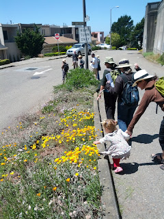
Spotting butterflies
I might have this wrong, but the Green Hairstreak only has two local hosts (plants on which it lays its eggs): deer weed and coastal buckwheat, the latter a humble-looking plant planted in nooks and crannies, DPW-owned land, and parks dotting14th and 15th Avenue between Hawk Hill and Turtle Hill. The Green Hairstreak sups nectar from wild cucumber and seaside daisy, also planted in this corridor.

THE ROUTE
We met at 14th Avenue and Rivera Street, at the base of Hawk Hill. Hoover Middle School is right there too; apparently the kids are involved to some extent in cultivating native plants. (Right on to whomever is helping teach them to appreciate and care for their local environment!) 

Rocky Outcrop Park
We wandered up 14th Avenue, a mostly treeless, concrete slab, like much of the Avenues and my own neighborhood of Vis Valley. Paul Chasen from the Green Connections group of the SF Planning Department talked about the future vision of streets as green corridors. The City has changed a lot since I was a kid in the Eighties, and though I hated change in the Nineties, I'm actually excited about what it will be like twenty years from now, when my daughter is an adult.

We passed Golden Gate Heights Park, where I believe was a great big retaining wall made of concrete. Wild cucumber grows at its base (wouldn't it be cool to cover the wall with trellis?). At Rocky Outcrop Park, at 14th and Ortega, we saw some of the oldest coastal buckwheat, according to Melanie Trellis, a site steward with Nature in the City, and Diedre Martin, who's involved with the backyard nursery network. 
Moraga & 14th & 15th

At Moraga, between 15th and 16th, is an amazing staircase covered in tile mosaics. I've seen photos of this incredible project, but this was my first time here. Coupled with the Green Hairstreak corridor, the local residents are awfully lucky to have such cool things going on in their hood

The walk ended at Grandview Park, which locals call Turtle Hill, my new favorite place to hike for an amazing view. According to Park & Rec, it's a "dune island" made of bedrock and 140-million year old Franciscan chert, which is essentially lots of tiny sea critters. While up top, hawks and crows bandied around in the sky, a cold wind blew, and the view was clear all the way to the Farallones.

Turtle Hill, intersection of 14th &15th Avenues
CONSERVATION
Through great human efforts towards conservation--and the tenacity of the butterfly itself--the Green Hairstreak continues to exist in San Francisco. Most of its habitat has been destroyed, obviously. Just look at the concrete slab that most of the City is, especially in the Avenues. Groups like Nature in the City and Green Connections (and many others) want species like this to survive. It's incredible to think that what we plant in our gardens makes a difference.

Native Plant Nurseries:
Relevant Websites:


Starting Point (14th & Rivera, at the base of Hawk Hill):


View Larger Map


GREEN HAIRSTREAK WORKDAY
Meet at 14th and Pacheco on the
3rd Saturday of every month from
10 am - 1 pm

Bringing your own tools & gloves is welcomed!
Email stewards@natureinthecity.org if you have questions.